WMS:Floodplain Delineation
The floodplain delineation portion of the stochastic modeling uses the results from each HEC-RAS model to develop a floodplain for each run. The floodplain delineation is the same model used by WMS to perform individual floodplain delineations.
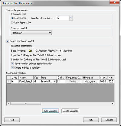
The only parameters at this point that can be varied within a range of probable answers the search radius of the floodplain delineation. This is done by setting the search radius in the Floodplain Delineation Options be a negative number. This negative number is a key number and should be unique for each stochastic variable created. When running the stochastic simulation WMS will substitute the simulation specific parameter for the defined key. Then setup a stochastic variable for Floodplain in the Stochastic Run Parameters dialog. A key value (matching the key as defined in the materials property) starting value, min value, max value, standard deviation and distribution type.
Previous Step in Stochastic Modeling
Next Step in Stochastic Modeling
Related Topics
WMS – Watershed Modeling System | ||
|---|---|---|
| Modules: | Terrain Data • Drainage • Map • Hydrologic Modeling • River • GIS • 2D Grid • 2D Scatter |  |
| Models: | CE-QUAL-W2 • GSSHA • HEC-1 • HEC-HMS • HEC-RAS • HSPF • MODRAT • NSS • OC Hydrograph • OC Rational • Rational • River Tools • Storm Drain • SMPDBK • SWMM • TR-20 • TR-55 | |
| Toolbars: | Modules • Macros • Units • Digitize • Static Tools • Dynamic Tools • Drawing • Get Data Tools | |
| Aquaveo | ||
