WMS:HEC-HMS Meteorological Options
From XMS Wiki
Jump to navigationJump to search
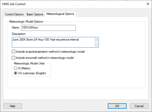
The meteorological option data entered in WMS is exported to the HMS project and used to set the appropriate HMS parameters when you read the project into HMS. The data included in the basin model include the name, description, and the other items in the Meteorological Options tab shown below:
You can define all other meteorological data in the Defining the Meteorological Model dialog.
Related Topics:
WMS – Watershed Modeling System | ||
|---|---|---|
| Modules: | Terrain Data • Drainage • Map • Hydrologic Modeling • River • GIS • 2D Grid • 2D Scatter |  |
| Models: | CE-QUAL-W2 • GSSHA • HEC-1 • HEC-HMS • HEC-RAS • HSPF • MODRAT • NSS • OC Hydrograph • OC Rational • Rational • River Tools • Storm Drain • SMPDBK • SWMM • TR-20 • TR-55 | |
| Toolbars: | Modules • Macros • Units • Digitize • Static Tools • Dynamic Tools • Drawing • Get Data Tools | |
| Aquaveo | ||
