WMS:Drainage Module Feature Objects
The drainage module has a number of tools to edit feature objects. The dialogs can be reached by double-clicking on feature object or by selecting the feature object then selecting Attributes from the Feature Objects Menu.
Feature Arc Type
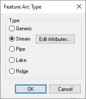
This dialog is accessed by selecting a feature arc. The type of arc can be selected from this dialog. Available types are:
- Generic
- Stream
- Pipe
- Lake
- Ridge
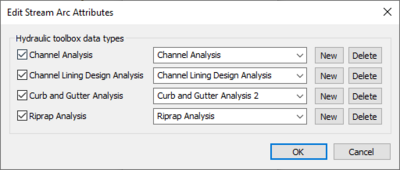
Selecting the Stream option makes the Edit Attributes button active. Clicking on this button will bring up the Edit Stream Arc Attributes dialog.
Feature Point Type
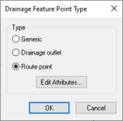
This dialog allows the user to select the point type. It is accessed by selecting a feature node point. Available types in the drainage module are:
- Generic
- Drainage outlet
- Route point
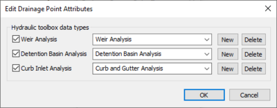
When the Route point type is selected the Edit Attributes button becomes available. Clicking on this button will open the Edit Drainage Point Attributes dialog.
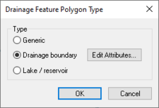
Feature Polygon Type
Selecting a feature polygon can bring up the Drainage Feature Polygon Type dialog. The dialog allows the user to designate the polygon type. Available types in the drainage module are:
- Generic
- Drainage boundary
- Lake / reservoir
Selecting the Drainage boundary option will make the Edit Attributes button active. This button will bring up the Edit Basin Polygon Attributes dialog.
Related Topics
WMS – Watershed Modeling System | ||
|---|---|---|
| Modules: | Terrain Data • Drainage • Map • Hydrologic Modeling • River • GIS • 2D Grid • 2D Scatter |  |
| Models: | CE-QUAL-W2 • GSSHA • HEC-1 • HEC-HMS • HEC-RAS • HSPF • MODRAT • NSS • OC Hydrograph • OC Rational • Rational • River Tools • Storm Drain • SMPDBK • SWMM • TR-20 • TR-55 | |
| Toolbars: | Modules • Macros • Units • Digitize • Static Tools • Dynamic Tools • Drawing • Get Data Tools | |
| Aquaveo | ||
