WMS:Tree Contents for 2D Grid Module
From XMS Wiki
Jump to navigationJump to search
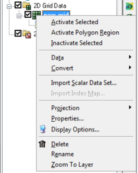
In the 2D Grid module, the grid and associated datasets are listed in the Project Explorer (WMS only allows users to work with one grid).
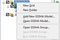
Right-clicking on the main 2D Grid Data folder allows users to create a New Grid, New folder, or GSSHA Model options.
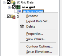
Right-clicking on the dataset for a grid allows users to Export, Rename, view Properties, View Values, set Contour Options, and Set as Elevations.
Related Topics
WMS – Watershed Modeling System | ||
|---|---|---|
| Modules: | Terrain Data • Drainage • Map • Hydrologic Modeling • River • GIS • 2D Grid • 2D Scatter |  |
| Models: | CE-QUAL-W2 • GSSHA • HEC-1 • HEC-HMS • HEC-RAS • HSPF • MODRAT • NSS • OC Hydrograph • OC Rational • Rational • River Tools • Storm Drain • SMPDBK • SWMM • TR-20 • TR-55 | |
| Toolbars: | Modules • Macros • Units • Digitize • Static Tools • Dynamic Tools • Drawing • Get Data Tools | |
| Aquaveo | ||


