WMS:Terrain Data Module: Difference between revisions
From XMS Wiki
Jump to navigationJump to search
No edit summary |
No edit summary |
||
| (One intermediate revision by the same user not shown) | |||
| Line 4: | Line 4: | ||
Floodplain delineation using scattered datasets and TINs is also handled from the Terrain Data module. | Floodplain delineation using scattered datasets and TINs is also handled from the Terrain Data module. | ||
The graphical interface for the Terrain Data module consists of tools, menus (TIN, [[WMS:DEM Menu|DEM,]] and Flood), and the Project Explorer. | The graphical interface for the Terrain Data module consists of tools, menus ([[WMS:TIN Menu|TIN,]] [[WMS:DEM Menu|DEM,]] and [[WMS:Overview_of_Floodplain_Delineation#Flood_Menu|Flood]]), and the Project Explorer. | ||
The Terrain Data module is included with all [http://www.aquaveo.com/software/wms-pricing paid editions] of WMS. [[Category:Link to Store]] | The Terrain Data module is included with all [http://www.aquaveo.com/software/wms-pricing paid editions] of WMS. [[Category:Link to Store]] | ||
Latest revision as of 15:39, 13 December 2019
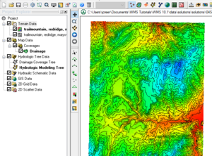
The Terrain Data module imports, edits, and prepares digital terrain data (DEMs, and TINs) for hydrologic and hydraulic modeling. The module contains several tools for thinning, smoothing, clipping, and editing the data.
Floodplain delineation using scattered datasets and TINs is also handled from the Terrain Data module.
The graphical interface for the Terrain Data module consists of tools, menus (TIN, DEM, and Flood), and the Project Explorer.
The Terrain Data module is included with all paid editions of WMS.
Related Topics
- DEMs
- TINs
- Floodplain Delineation
- Project Explorer Contents for Terrain Data Module
- Scattered Data
- Drainage Delineation
WMS – Watershed Modeling System | ||
|---|---|---|
| Modules: | Terrain Data • Drainage • Map • Hydrologic Modeling • River • GIS • 2D Grid • 2D Scatter |  |
| Models: | CE-QUAL-W2 • GSSHA • HEC-1 • HEC-HMS • HEC-RAS • HSPF • MODRAT • NSS • OC Hydrograph • OC Rational • Rational • River Tools • Storm Drain • SMPDBK • SWMM • TR-20 • TR-55 | |
| Toolbars: | Modules • Macros • Units • Digitize • Static Tools • Dynamic Tools • Drawing • Get Data Tools | |
| Aquaveo | ||
