WMS:What's new in WMS version 11.1: Difference between revisions
From XMS Wiki
Jump to navigationJump to search
| Line 7: | Line 7: | ||
===GIS Module=== | ===GIS Module=== | ||
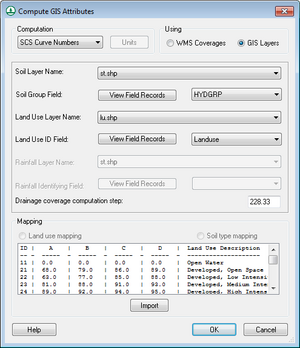
*Faster/more robust GIS parameter computations directly from shapefiles.[[File:Compute GIS Attributes 11.1.png|thumb|Compute GIS Attributes]] | *Faster/more robust GIS parameter computations directly from shapefiles.[[File:Compute GIS Attributes 11.1.png|thumb|Compute GIS Attributes]] | ||
*Faster | *Faster shapefile to feature object conversion. | ||
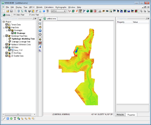
*Improved display speed of large raster files. | *Improved display speed of large raster files.[[File:Large Raster.png|thumb|Imported large raster]] | ||
*Addition of Web-based Google tile map services as Online Maps that can be displayed as background maps. | *Addition of Web-based Google tile map services as Online Maps that can be displayed as background maps. | ||
*Add additional features to online maps to use tile map services and other types of services as online maps. | *Add additional features to online maps to use tile map services and other types of services as online maps. | ||
Revision as of 20:34, 8 January 2021
| This contains information about future functionality available starting at WMS version 11.1. The content may not apply to other versions. |
The WMS software development team is excited about the release of WMS 11.1! This page lists the exciting new features that have been added to WMS 11.1.
What's new in WMS 11.1
GIS Module
- Faster/more robust GIS parameter computations directly from shapefiles.
- Faster shapefile to feature object conversion.
- Improved display speed of large raster files.
- Addition of Web-based Google tile map services as Online Maps that can be displayed as background maps.
- Add additional features to online maps to use tile map services and other types of services as online maps.
- Improvements to display and operations on images and raster files of various types.
GSSHA
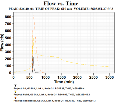
- View multiple scenario hydrographs in GSSHA solution:
- Added capability to run calibration on Richard’s Equation parameters in GSSHA.
Map Data
- “Extract Features” tool that allows you to directly convert raster data to stream and ridge/embankment centerlines.
- Map flood tool: Add an option to use local shapefiles for Base Flood Elevations and floodplain boundary polygons when web service data are not available.
Rational Methed
- Better support for entering/computing Rational Method IDF curves.
Models
- Fix various issues in GSSHA, HEC-1, HEC-HMS, HEC-RAS, NSS, Rational, and MODRAT models and make improvements/updates to model interfaces.
- Updated to the latest versions of the HEC-HMS and GSSHA models.
Bugfixes
Visit the WMS bugfix page to view the list of bugs fixed.
WMS – Watershed Modeling System | ||
|---|---|---|
| Modules: | Terrain Data • Drainage • Map • Hydrologic Modeling • River • GIS • 2D Grid • 2D Scatter |  |
| Models: | CE-QUAL-W2 • GSSHA • HEC-1 • HEC-HMS • HEC-RAS • HSPF • MODRAT • NSS • OC Hydrograph • OC Rational • Rational • River Tools • Storm Drain • SMPDBK • SWMM • TR-20 • TR-55 | |
| Toolbars: | Modules • Macros • Units • Digitize • Static Tools • Dynamic Tools • Drawing • Get Data Tools | |
| Aquaveo | ||


