Category:GIS: Difference between revisions
From XMS Wiki
Jump to navigationJump to search
No edit summary |
No edit summary |
||
| Line 1: | Line 1: | ||
Articles related to the GIS module. | Articles related to the [[GIS]] module. | ||
[[Category:GMS Modules]] | [[Category:GMS Modules]] | ||
Revision as of 15:41, 2 June 2016
Articles related to the GIS module.
Subcategories
This category has the following 5 subcategories, out of 5 total.
Pages in category "GIS"
The following 25 pages are in this category, out of 25 total.
C
Media in category "GIS"
The following 64 files are in this category, out of 64 total.
- Add Data Dialog.jpg 507 × 340; 47 KB
- DisplayGIS.png 733 × 573; 20 KB
- DynamicImagery.svg 227 × 226; 655 KB
- ESRIbackgroundmap.png 1,726 × 971; 2.92 MB
- FeatureContoursGivenElevation.jpg 763 × 519; 148 KB
- FillWithFilter.png 675 × 721; 83 KB
- GIS CreateContourArc.jpg 284 × 134; 4 KB
- GIS DataFolder.png 276 × 122; 2 KB
- GIS DataRight-ClickMenu.png 276 × 248; 5 KB
- GIS FeatureContours.jpg 829 × 611; 186 KB
- GIS Folder.svg 60 × 60; 303 KB
- GIS LayerProperties.png 642 × 441; 38 KB
- GIS Module Icon.svg 60 × 60; 381 KB
- GIS Right-ClickMenu1.png 275 × 108; 3 KB
- GIS SelectData.png 507 × 340; 24 KB
- GIS to Feature Objects Wizard -- Step 1 of 2.jpg 740 × 485; 31 KB
- GIS to Feature Step1.png 479 × 445; 13 KB
- GISchecklayers.jpg 276 × 140; 12 KB
- GISFolder.png 16 × 16; 507 bytes
- GISidentify.jpg 295 × 191; 18 KB
- GISrightMenu.jpg 570 × 585; 146 KB
- GlobalLandUseTable.txt ; 2 KB
- Identify tool icon.png 15 × 16; 430 bytes
- Identify Tool.svg 60 × 60; 3 KB
- IdentifyResults.jpg 493 × 244; 33 KB
- Lidar1 b.png 1,440 × 900; 916 KB
- Lidar1 w.png 1,440 × 900; 913 KB
- LidarInTree.png 124 × 60; 3 KB
- LidarMtStHelensExample.png 956 × 571; 154 KB
- MergeRasterCellSize.jpg 288 × 157; 15 KB
- MIF-MID Import.png 274 × 146; 4 KB
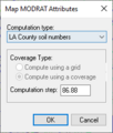
- MODRATMapAtts.png 202 × 237; 5 KB
- NLCD2006LuCodes.txt ; 746 bytes
- Raster-to-flood-depths.png 336 × 285; 16 KB
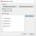
- RasterDisplayOptions.png 405 × 416; 13 KB
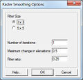
- RasterSmoothingOpts.jpg 280 × 270; 23 KB
- RasterToScatter.png 364 × 147; 5 KB
- RasterToScatterExample.jpg 689 × 514; 182 KB
- RasterTrimWarning.jpg 468 × 171; 21 KB
- ResampledRasterData.jpg 780 × 510; 148 KB
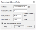
- ResampleExportRaster.png 278 × 237; 9 KB
- Select GIS Feature Tool.svg 60 × 66; 4 KB
- Select Object tool.png 9 × 16; 339 bytes
- Select Object Tool.svg 26 × 51; 2 KB
- TrimmedRaster1.jpg 904 × 533; 187 KB
- TrimmedRaster2.jpg 894 × 520; 215 KB
- TrimmedRaster3.jpg 876 × 523; 112 KB
- VectorLuCodes.txt ; 1 KB
- WMSArcObjectsCadTinTreeIcon.png 16 × 18; 429 bytes
- WMSArcObjectsRasterTreeIcon.png 16 × 18; 480 bytes
- WMSGISElevationImageTreeIcon.png 16 × 18; 471 bytes
- WMSGISPaletteImageTreeIcon.png 16 × 18; 525 bytes
- WMSGISRasterImageTreeIcon.png 16 × 18; 625 bytes
- WMSGISVectorDataTreeIcon.png 16 × 18; 553 bytes
- WMSIcon GIS Module.png 16 × 16; 767 bytes
- WMSIcon GIS Palette.png 59 × 26; 1 KB
- WMSIcon Select Features - inactive.png 16 × 16; 504 bytes
- WMSIcon Select Features.png 16 × 16; 453 bytes
- WMSLineShapefileTreeIcon.png 16 × 18; 341 bytes
- WMSOnlineGISElevationImageTreeIcon.png 16 × 18; 540 bytes
- WMSOnlineGISPaletteImageTreeIcon.png 16 × 18; 586 bytes
- WMSOnlineGISRasterImageTreeIcon.png 16 × 18; 743 bytes
- WMSPointShapefileTreeIcon.png 16 × 18; 365 bytes
- WMSPolygonShapefileTreeIcon.png 16 × 18; 400 bytes


