WMS:ARC/INFO ASCII Grid Files
From XMS Wiki
Jump to navigationJump to search
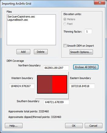
WMS can import ARC/INFO® ASCII grid for use as a background DEM. Since it is a simple file format, other digital elevation data can be formatted in the same way and then imported into WMS using the Open command in the File menu. This will bring up the Importing ArcInfo Grid dialog.
The CASC2D model may also import and used ARC/INFO® grid files when defining map parameters. The file format is shown in Figure 1 and an example file in Figure 2.
| ncols ncol | /* Number of columns in the grid */ |
| nrows nrow | /* Number of rows in the grid */ |
| xllcorner x | /* Lower left x coordinate of grid */ |
| yllcorner y | /* Lower left x coordinate of grid */ |
| cellsize size | /* Grid cell size */ |
| NODATRA_value NODATA | /* value of an empty grid cell */ |
| z11 z12 z13 ... z1ncols | /* values of row 1 */ |
| z21 z22 z23 ... z2ncols | /* values of row 2 */ |
| . | |
| . | |
| . | |
| znrows1 znrows2 znrows3 ... znrowsncols | /* values of last row*/ |
Figure 1. ARC/INFO® ASCII Grid File Format.
| ncols 128 |
| nrows 136 |
| xllcorner 422415 |
| yllcorner 4515405 |
| cellsize 30 |
| NODATA_value -9999 |
| 1287 1286 1286 1288 ... |
| 1288 1288 -9999 1289 ... |
| . |
| . |
| 1282 -9999 1283 1284 ... |
Figure 2. Sample ARC/INFO® ASCII Grid File.
The card types used in the ARC/INFO® grid file format are self explanatory.
| [hide] WMS – Watershed Modeling System | ||
|---|---|---|
| Modules: | Terrain Data • Drainage • Map • Hydrologic Modeling • River • GIS • 2D Grid • 2D Scatter |  |
| Models: | CE-QUAL-W2 • GSSHA • HEC-1 • HEC-HMS • HEC-RAS • HSPF • MODRAT • NSS • OC Hydrograph • OC Rational • Rational • River Tools • Storm Drain • SMPDBK • SWMM • TR-20 • TR-55 | |
| Toolbars: | Modules • Macros • Units • Digitize • Static Tools • Dynamic Tools • Drawing • Get Data Tools | |
| Aquaveo | ||
