WMS:Assigning an Equation
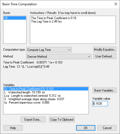
The Basin Time Computation dialog allows selecting from one of several pre-defined equations. The Equation drop-down box lists the available methods for computing lag time or time concentration and is controlled by setting the computation type combo box to the desired setting. Once an equation has been selected, the Instructions / Results window will identify any variables with zero values and instruct to define values for them. Variables are assigned values by selecting the variable from the Variables text window and then assigning a value to it in the edit box to the right. Once all variables are defined the Instructions / Results window will display the computed lag time or time of concentration.
Basin Time Computation Dialog
Accessed by selecting Compute Parameters-Basin Data in the HEC-1 Unit Hydrograph Methods dialog. Basin – Instructions / Results (You may have to scroll down) – Computational type: –
Units – The units that apply to the definition chosen.
- "none"
- "ft"
- "m"
- "km"
- "mi"
- hr"
- "min"
- "sec"
- "sq. mi"
- "sq. km"
- "sq. ft"
- "acre"
- "hect"
- "in"
- "mm"
- "ft/mi"
- "fract"
Method: – Estimation of the channel velocity measured in feet per second.
Variable Value – Enter the variable value.
Export Data – When is selected a dialog will appear that will ask whether you want to append to an existing file or export a new one.
Copy to Clipboard – Select to copy to clip board.
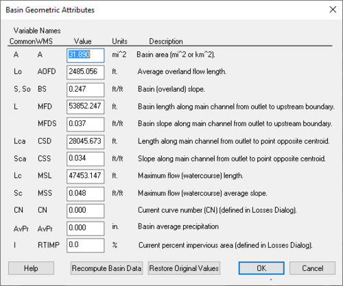
WMS:Basin Geometric Attributes Dialog
Accessed by selecting Basin Geometrical Attributes located in the HEC-1 Unit Hydrograph Methods dialog. Variable Names – Below the Variable Names heading is a table that allows the inputting of values for each one of the listed variables' names.
Recompute Basin Data – Select to bring up the Units dialog.
Restore Original Values – Select to revert all values in the Variable Names table back to their original values.
Related Topics
| [hide] WMS – Watershed Modeling System | ||
|---|---|---|
| Modules: | Terrain Data • Drainage • Map • Hydrologic Modeling • River • GIS • 2D Grid • 2D Scatter |  |
| Models: | CE-QUAL-W2 • GSSHA • HEC-1 • HEC-HMS • HEC-RAS • HSPF • MODRAT • NSS • OC Hydrograph • OC Rational • Rational • River Tools • Storm Drain • SMPDBK • SWMM • TR-20 • TR-55 | |
| Toolbars: | Modules • Macros • Units • Digitize • Static Tools • Dynamic Tools • Drawing • Get Data Tools | |
| Aquaveo | ||

