WMS:GSSHA Model Check
From XMS Wiki
Jump to navigationJump to search
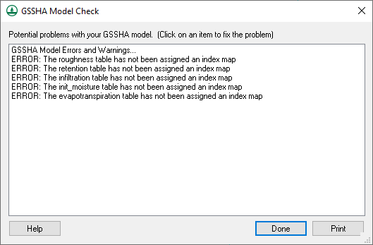
The GSSHA Model Check command runs through the input data for a GSSHA simulation and looks for obvious inconsistencies and problems with the model. The model checker will not identify values that are outside of plausible ranges, etc., only logical problems. For example, an index map has one or more cells whose ID is 0 (which is not allowed in GSSHA), or a specified process that has an ID with parameters whose values are 0.00 (which indicates an incomplete entry). An example of a problem that the model checker would not find is if a stream arc has a pit that pools water.
Related Topics
GSSHA | |
|---|---|
| XMS Wiki Links | Calibration (Automated • Manual • Output) • Channel Routing • Contaminants • Digital Dams • Embankment Arcs • Feature Objects (Arcs • Nodes • Polygons) • File Types • Groundwater • Groups • Hydraulic Structures • Job Control • Join SSURGO Data • Mapping Tables • Maps • Menu • Model Linkage • Multiple Simulations • Nutrients • Observations • Output Control • Overland Soil Erosion • Pipe and Node Parameters • Precipitation • Radar Rainfall • Save GSSHA Project File • Smooth GSSHA Streams • Snowmelt • Solution (Analysis • Data) |
| Related Tools | MWBM Wizard • Using Soil Type Data with GSSHA |
| GSSHA Wiki External Links | GSSHA Wiki: Overview • Primer • User's Manual • Tutorials |
