GMS:MODFLOW-USG
| MODFLOW | |
|---|---|
| Pre-processing | |
| MODFLOW Commands | |
| Building a MODFLOW Model | |
| Map to MODFLOW | |
| Calibration | |
| Packages Supported in GMS | |
| Saving a MODFLOW Simulation | |
| Importing MODFLOW Files | |
| Unsupported MODFLOW Features | |
| Run MODFLOW | |
| Post-processing | |
| MODFLOW Display Options | |
| MODFLOW Post-Processing Viewing Options | |
| Reading a MODFLOW Simulation | |
| Tutorials | |
| Packages | |
| Flow: | BCF6, HUF, LPF, UPW |
| Solvers: | SMS |
| Other: | UZF1 |
Starting at GMS version 10.0, GMS supports MODFLOW-USG. MODFLOW-USG is a version of MODFLOW based on finite volume calculations, thus allowing for many different types of grid cells. This allows the model grid to more accurately match the model domain and be more efficiently refined in areas where more accuracy is desired.
MODFLOW-USG models are built using unstructured grids, or UGrids, which are a new (as of GMS 10.0) type of geometric object that can handle the wide variety of cell types supported by MODFLOW-USG.
Choosing MODFLOW Version
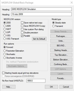
Only MODFLOW-USG is supported when using unstructured grids. MODLFOW-USG can also be used for a model using a 3D grid. Choosing to use MODFLOW-USG is done in the MODFLOW Global Options dialog. With a 3D grid at any time the user can switch from one MODFLOW version to another.
Unsupported Features
GMS does not yet support the following MODFLOW-USG features. Work on supporting more features is ongoing.
- Packages/processes
- CLN Process
- GNC Package
- GMS cannot read MODFLOW-USG files written by any non-GMS software. This is because there is currently no standard way to define the unstructured grid geometry. GMS writes a .vtu file (VTK Unstructured Grid file) with the MODFLOW files to define the grid geometry.
| This contains information about a future release of GMS. The content may not apply to other versions. |
Beginning with GMS version 10.1 the CLN, GNC, and import features are supported. To import a model that was created outside of GMS either a *.vtu file or a *.gsf file must be present to define the grid geometry.
See also
| GMS – Groundwater Modeling System | ||
|---|---|---|
| Modules: | 2D Grid • 2D Mesh • 2D Scatter Point • 3D Grid • 3D Mesh • 3D Scatter Point • Boreholes • GIS • Map • Solid • TINs • UGrids | |
| Models: | FEFLOW • FEMWATER • HydroGeoSphere • MODAEM • MODFLOW • MODPATH • mod-PATH3DU • MT3DMS • MT3D-USGS • PEST • PHT3D • RT3D • SEAM3D • SEAWAT • SEEP2D • T-PROGS • ZONEBUDGET | |
| Aquaveo | ||
