WMS:Define Culvert Roadway Data
Overview
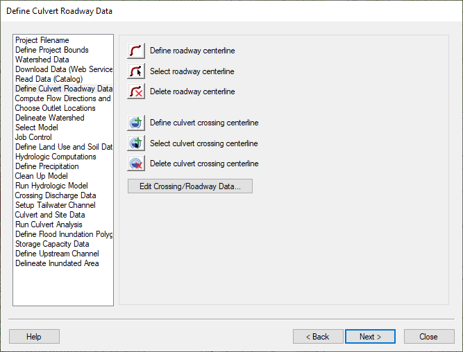
The Define Culvert Roadway Data step is used to define the culvert and roadway centerlines as arcs and the data associated with these structures.
Help
When clicking on the define roadway centerline button, WMS either gets the HY8 coverage and makes it the active coverage or creates a new HY8 coverage if one does not exist and makes this the active coverage. Any roadway centerline arcs should be created in the HY8 coverage. Separate display options exist for roadway arcs, upstream arcs, downstream (tailwater) arcs, culvert arcs and flood inundation polygons.
Selecting the define culvert crossing centerline button works in much the same way as the define roadway centerline button, except a culvert arc is created when the user clicks in the graphics window. Culverts and all water conveyance arcs in the HY-8 coverage should be created from upstream to downstream, and an arrow shows the flow direction of each type of arc.
If no roadway arcs are selected, clicking on the edit crossing/roadway data button selects all the roadway arcs in the HY8 coverage and brings up the arc attributes for these arcs. If roadway arcs are selected, only the selected roadway arc attributes are shown. The culvert and roadway arc attributes are shown in a spreadsheet window.
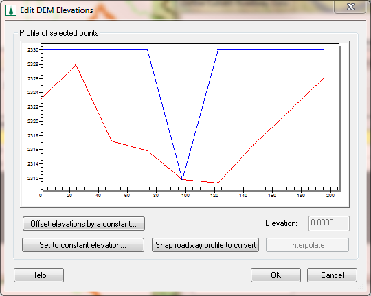
For the roadway attributes, a button exists that brings up the roadway elevation profile, as shown here:
This dialog works in much the same way as the Edit Elevations dialog in the DEM menu. If the Snap roadway profile to culvert button is selected, WMS determines the intersection of the roadway and the culvert and returns this elevation to the original DEM elevation.
For more information on how WMS uses this data to set the HY8 Roadway Data, please see: Path of Data from WMS to HY8
HY8 Modeling Wizard Steps: Project Filename · Define Project Bounds · Watershed Data · Download Data (Web Service Client) · Read Data (Catalog) · Define Culvert Roadway Data · Compute Flow Directions and Flow Accumulations · Choose Outlet Locations · Delineate Watershed · Select Model · Job Control · Define Land Use and Soil Data · Hydrologic Computations · Define Precipitation · Clean Up Model · Run Hydrologic Model · Crossing Discharge Data · Setup Tailwater Channel · Culvert and Site Data · Run Culvert Analysis · Define Flood Inundation Polygon · Storage Capacity Data · Define Upstream Channel · Delineate Inundated Area
WMS – Watershed Modeling System | ||
|---|---|---|
| Modules: | Terrain Data • Drainage • Map • Hydrologic Modeling • River • GIS • 2D Grid • 2D Scatter |  |
| Models: | CE-QUAL-W2 • GSSHA • HEC-1 • HEC-HMS • HEC-RAS • HSPF • MODRAT • NSS • OC Hydrograph • OC Rational • Rational • River Tools • Storm Drain • SMPDBK • SWMM • TR-20 • TR-55 | |
| Toolbars: | Modules • Macros • Units • Digitize • Static Tools • Dynamic Tools • Drawing • Get Data Tools | |
| Aquaveo | ||

