WMS:Run Hydrologic Model: Difference between revisions
No edit summary |
(→Help) |
||
| Line 6: | Line 6: | ||
If the current model is one of the models that is run from within WMS (TR-55, NSS, or Rational), this step only has a button to run the simulation. Since each model has different input and output files, WMS does not display all the input/output file edit fields for all of the models. | If the current model is one of the models that is run from within WMS (TR-55, NSS, or Rational), this step only has a button to run the simulation. Since each model has different input and output files, WMS does not display all the input/output file edit fields for all of the models. | ||
{{WMSHydroModWizard}} | {{WMSHydroModWizard}} | ||
Revision as of 15:59, 23 February 2016
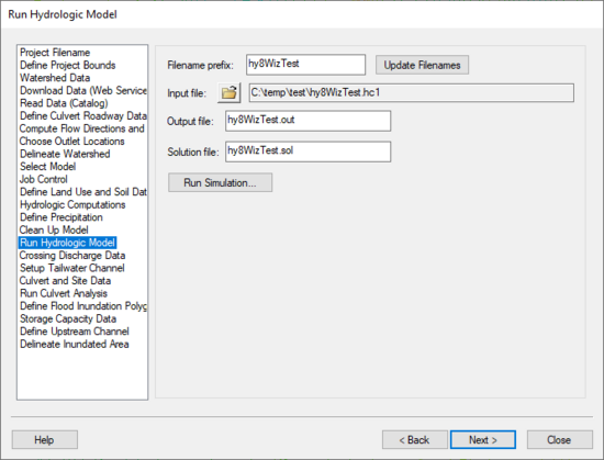
The Run Hydrologic Model step is used to run the hydrologic model and read the resulting hydrograph.
Help
If the current model is one of the models that is run from within WMS (TR-55, NSS, or Rational), this step only has a button to run the simulation. Since each model has different input and output files, WMS does not display all the input/output file edit fields for all of the models.
Hydrologic Modeling Wizard Steps: Project Filename · Define Project Bounds · Watershed Data · Download Data (Web Service Client) · Read Data (Catalog) · Compute Flow Directions and Flow Accumulations · Choose Outlet Locations · Delineate Watershed · Select Model · Define and Smooth Streams · Create 2D Grid · Job Control · Define Land Use and Soil Data · Hydrologic Computations · Define Precipitation · Clean Up Model · Run Hydrologic Model
HY8 Modeling Wizard Steps: Project Filename · Define Project Bounds · Watershed Data · Download Data (Web Service Client) · Read Data (Catalog) · Define Culvert Roadway Data · Compute Flow Directions and Flow Accumulations · Choose Outlet Locations · Delineate Watershed · Select Model · Job Control · Define Land Use and Soil Data · Hydrologic Computations · Define Precipitation · Clean Up Model · Run Hydrologic Model · Crossing Discharge Data · Setup Tailwater Channel · Culvert and Site Data · Run Culvert Analysis · Define Flood Inundation Polygon · Storage Capacity Data · Define Upstream Channel · Delineate Inundated Area
WMS – Watershed Modeling System | ||
|---|---|---|
| Modules: | Terrain Data • Drainage • Map • Hydrologic Modeling • River • GIS • 2D Grid • 2D Scatter |  |
| Models: | CE-QUAL-W2 • GSSHA • HEC-1 • HEC-HMS • HEC-RAS • HSPF • MODRAT • NSS • OC Hydrograph • OC Rational • Rational • River Tools • Storm Drain • SMPDBK • SWMM • TR-20 • TR-55 | |
| Toolbars: | Modules • Macros • Units • Digitize • Static Tools • Dynamic Tools • Drawing • Get Data Tools | |
| Aquaveo | ||
