Category:Noindexed pages
From XMS Wiki
Jump to navigationJump to search
Pages tagged with {{noindex}}
.
Pages in category "Noindexed pages"
The following 200 pages are in this category, out of 587 total.
(previous page) (next page)A
- SMS:ADCIRC Check/Fix Levee Ground Elevations Tool
- SMS:ADCIRC Coverage 12.3 and earlier
- Template:ADCIRC Map Viewer
- SMS:ADCIRC Tools
- GMS:ADH
- SMS:ADH Bed Layers Assignment
- SMS:ADH Boundary Condition Assignment
- SMS:ADH Consolidation
- SMS:ADH Extract WSE
- SMS:ADH Hot Start Initial Conditions
- SMS:ADH Material Properties
- SMS:ADH Model Control
- SMS:ADH Model Control Advanced
- SMS:ADH Model Control Global Material Properties
- SMS:ADH Model Control Iterations
- SMS:ADH Model Control Model Parameters
- SMS:ADH Model Control Output
- SMS:ADH Model Control Solver
- SMS:ADH Model Control Time
- SMS:ADH Run Model
- SMS:ADH Sediment Library Control
- SMS:ADH Sediment Transport and Bed Layers
- SMS:ADH SMS 13.2 and Earlier
- SMS:ADH Time Series
- SMS:ADH Transport Constituents
- SMS:ADH Velocity Series Editor
- SMS:ADH Vessel Coverage
- SMS:ADH Wind Stations
- Template:Advective Courant Number
- Template:Advective Time Step
- Template:Angle Convention
- Template:Arcs from UGrid Points
- Template:Arcs to Polygons
- GMS:ART3D
- Template:Assign Spectral Data
- User:Astone/template
- User:Astone/testpage
- User:Astone/workflow testpage
- SMS:Auto-Backup Tools
B
C
- Template:Canopy Coefficient
- SMS:Cascade
- Template:Cell Dataset from Point Dataset
- Template:Centroids from Polygons Tool
- Template:Check/Fix Levee Crest Elevations
- Template:Check/Fix Levee Ground Elevations
- Template:Chezy Friction
- User:Chopkin
- Template:Clean Dams Tool
- Template:Clip Raster from Elevation
- Template:Clip Tool
- User:Cmadsen/GSSHA Permafrost
- User:Cmadsen/GSSHA Workflow
- User:Cmadsen/template creation
- SMS:CMS-Flow Cell Attributes
- SMS:CMS-Flow Graphical Interface
- SMS:CMS-Flow Grid Modification Flag
- SMS:CMS-Flow Hard Bottom
- Template:CMS-Flow Hard Bottom Dataset
- SMS:CMS-Flow Observation Cells
- SMS:CMS-Flow Tidal Constituents
- SMS:CMS-Flow Time Control
- SMS:CMS-Flow Transport Control
- SMS:CMS-Flow User-Editable Datasets
- SMS:CMS-Flow/Save Points
- SMS:CMS-Wave Nesting Options Dialog
- SMS:CMS-Wave Project Workflow
- SMS:CMS-Wave Structure Types
- Template:Compare Datasets
- Template:Conservative Smoothing Filter
- Template:Contours from Raster
- Template:Contours from Single Raster Value
- Template:Convert 3D Data to 2D Data
- Template:Convert Cell Dataset to Point Dataset
- SMS:Convert From Mesh/Scatter
- Template:Convert Mesh/Scatter/Cartesian Grid to UGrid
- Template:Convert Point Dataset to Cell Dataset
- Template:Convert to 2D Mesh
- Template:Convert to Voronoi UGrid
- Template:Create Bridge Footprint
- SMS:Create Datasets
- Template:Create Locked Nodes Dataset from Coverage
- WMS:Create Reservoir (DEMs)
- WMS:Create Reservoir in DEM
- WMS:Create Reservoir in DEMs
- WMS:Create Reservoir in Digital Elevation Models
- WMS:Create Reservoirs in DEMs
- WMS:Create Storage Capacity Curves
- WMS:Creating a Storage Capacity Curve
- WMS:Creating Storage Capacity Curves
- SMS:CSHORE
- SMS:CSTORM-MS
D
- Template:D8 Flow Accumulation
- Template:D8 Flow Directions
- Template:Dataset Calculator
- Template:Dataset Calculator Table
- Template:Dataset Calculator Table Examples
- Template:Dataset to Raster
- WMS:DEM Create Reservoir
- WMS:DEM Create Reservoirs
- Template:Directional Roughness
- SMS:Dredge Source Model
- SMS:Dredging Coverage
- SMS:Dredging Material Properties Stickiness
- SMS:Dredging Scheduling
- SMS:Dredging Sediment Characteristics
- SMS:Dredging Simulations
- User:Dwood1/SMS:Version History
- User:Dwood1/WMS:Version History
- SMS:Dynamic Model Interface Schema
E
- Template:Edge Preserving Mean Filter
- Template:Edit Elevations
- SMS:EFDC Coverage
- SMS:ELCIRC
- GMS:Enabling ArcObjects
- Template:EWN Workflows
- Template:Export Curvilinear Grid
- Template:Export Horizontal Grid Tool
- Template:Export LandXML
- Template:Export tRIBS Mesh
- Template:Extend Raster
- Template:Extract Streams
- Template:Extract Subgrid Tool
- Template:Extract Submesh Tool
- Template:Extrude to 3D UGrid
- Template:Extrude UGrid
F
- Template:Feature Preserving Smoothing
- Template:Features from Raster
- GMS:FEMWATER Particle Sets
- SMS:FESWMS
- SMS:FESWMS Attributes Dialog
- SMS:FESWMS BC Nodestrings
- SMS:FESWMS executable known issues
- SMS:FESWMS Files
- SMS:FESWMS Graphical Interface
- SMS:FESWMS Hydraulic Structures
- SMS:FESWMS Material Properties
- SMS:FESWMS Menu
- SMS:FESWMS Model Control Dialog
- SMS:FESWMS Sediment Control
- SMS:FESWMS Spindown
- Template:Fill Depressions
- Template:Fill Holes in 2D Mesh
- Template:Fill Holes in UGrid
- Template:Fill Nodata
- Template:Filter Dataset
- Template:Filter Dataset Values
- SMS:Floodway Tools
- Template:Flow Accumulation Full Workflow
- SMS:FTP Site Info
G
- Template:Gaussian Filter
- SMS:Generic Grid Model
- SMS:GENESIS
- SMS:GENESIS Graphical Interface
- SMS:GENESIS Model Control Dialog
- SMS:GENESIS Observation Stations
- SMS:GENESIS Structures
- Template:Geometry Gradient
- GMS:GMS 10.0 Dialog Help
- GMS:GMS 10.1 Dialog Help
- GMS:GMS 10.2 Dialog Help
- GMS:GMS 10.3 Dialog Help
- GMS:GMS 10.4 Dialog Help
- GMS:GMS 10.5 Dialog Help
- GMS:GMS 10.6 Dialog Help
- GMS:GMS 10.7 Dialog Help
- GMS:GMS 10.8 Dialog Help
- GMS:GMS 11.0 Dialog Help
- GMS:GMS 6.5 Dialog Help
- GMS:GMS 7.0 Dialog Help
- GMS:GMS 8.0 Dialog Help
- GMS:GMS 8.1 Dialog Help
- GMS:GMS 8.3 Dialog Help
- GMS:GMS 9.0 Dialog Help
- GMS:GMS 9.1 Dialog Help
- GMS:GMS 9.2 Dialog Help
- GMS:GMS 99.99 Dialog Help
- GMS:GMS User Manual 10.0
- GMS:GMS User Manual 10.1
- GMS:GMS User Manual 10.2
- GMS:GMS User Manual 8.3
- GMS:GMS User Manual 9.0
- GMS:GMS User Manual 9.1
- GMS:GMS User Manual 9.2
- GMS:GMS User Manual Vol 1
- GMS:GMS User Manual Vol 2
- GMS:GMS User Manual Vol 3
- GMS:GMS User Manual Vol 4
- Template:Gravity Waves Courant Number
- Template:Gravity Waves Time Step
- Template:GSSHA 2D UGrid Tool
- Template:GSSHA Define and Smooth Streams Workflow
Media in category "Noindexed pages"
The following 13 files are in this category, out of 13 total.
- BridgeScourCoverageProperties.png 584 × 752; 33 KB
- BridgeScourDefaultOpts.png 359 × 296; 14 KB
- BridgeScourScenarioCritiVel.png 362 × 203; 9 KB
- BridgeScourSoilGeneration.png 353 × 230; 7 KB
- EditBridgeScourScenario.png 354 × 282; 12 KB
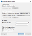
- FloodplainMapping Options.png 388 × 437; 21 KB
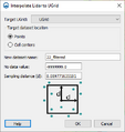
- Lidar to UGrid.png 348 × 368; 14 KB
- LidarDisplayOptions1.png 687 × 416; 19 KB
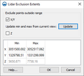
- LidarExclusionExtents.png 315 × 287; 9 KB
- LidarToRaster.png 314 × 244; 10 KB
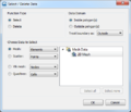
- SMS Select Delete Data.png 476 × 407; 32 KB
- SRH-2D Summary Report.png 361 × 596; 17 KB
- SWB ModelControl.png 533 × 935; 54 KB


