Category:Archived: Difference between revisions
From XMS Wiki
Jump to navigationJump to search
(Created page with "Articles and images that no longer used in release versions of XMS. Category:General Information") |
(hidden) |
||
| Line 1: | Line 1: | ||
__HIDDENCAT__ | |||
Articles and images that no longer used in release versions of XMS. | Articles and images that no longer used in release versions of XMS. | ||
[[Category:General Information]] | [[Category:General Information]] | ||
Revision as of 23:15, 21 October 2015
Articles and images that no longer used in release versions of XMS.
Subcategories
This category has the following 26 subcategories, out of 26 total.
1
- 1D River Dialogs (2 P, 10 F)
A
- Archived Icon Images (148 F)
- ART3D (1 P, 2 F)
B
- BASEMENT (2 P)
C
- Cascade Dialogs (1 P, 1 F)
- Archived CMS-Flow (13 P, 17 F)
- Coordinate Systems (19 P, 26 F)
- CSHORE (1 P)
- CSTORM-MS (1 P)
E
- EFDC Dialogs (1 P, 5 F)
- ELCIRC (2 P)
G
- GENESIS (4 P)
H
- HY-12 Dialogs (1 P, 9 F)
- HYDRO AS-2D Dialogs (1 P, 5 F)
M
- MWBM Dialogs (old) (13 F)
Q
- SMS Quick Tour (34 P, 36 F)
R
- RiverFlow2D (2 P)
S
- SMS 3D Cartesian Grid (2 P)
U
- UTCHEM (2 P, 1 F)
- UTEXAS Dialogs (2 P, 2 F)
W
Pages in category "Archived"
The following 146 pages are in this category, out of 146 total.
1
A
- SMS:ADCIRC Boundary Conditions 12.3 and earlier
- SMS:ADCIRC Coverage 12.3 and earlier
- SMS:ADCIRC Graphical Interface 12.3 and earlier
- SMS:ADCIRC Menu 12.3 and earlier
- SMS:ADCIRC Model Control 12.3 and earlier
- SMS:ADCIRC Spatial Attributes
- SMS:ADCIRC Weirs and Island Barriers
- GMS:ADH
- SMS:ADH Velocity Series Editor
- GMS:Arc Hydro Groundwater
- SMS:Archived Features
- GMS:Archived Features
- SMS:Archived Models
- GMS:ART3D
C
F
- GMS:FEMWATER Particle Sets
- SMS:FESWMS
- SMS:FESWMS Attributes Dialog
- SMS:FESWMS BC Nodestrings
- SMS:FESWMS executable known issues
- SMS:FESWMS Files
- SMS:FESWMS Graphical Interface
- SMS:FESWMS Hydraulic Structures
- SMS:FESWMS Material Properties
- SMS:FESWMS Menu
- SMS:FESWMS Model Control Dialog
- SMS:FESWMS Sediment Control
- SMS:FESWMS Spindown
- FHWA:2010 Webinars
- Flood Depth Raster Tool
- SMS:FTP Site Info
G
H
J
L
R
- Template:SMS at a glance raster module
- SMS:Raster Functionalities
- SMS:Raster Module
- SMS:Raster Module Interface
- User:Rcorrigan/Add WMS 11.2 Column
- User:Rcorrigan/GMS 10.6 Now Unsupported Table
- User:Rcorrigan/SMS 13.1 Now Unsupported Table
- SMS:Release Notes SMS 10.0
- SMS:Release Notes SMS 10.1
- SMS:Release Notes SMS 11.0
- SMS:Release Notes SMS 11.1
- SMS:Release Notes SMS 11.2
- SMS:Release Notes SMS 12.0
- GMS:Report A Bug
- SMS:Report Bug
- SMS:RiverFlow2D
- RMA4 errors
S
- SMS:Sample Problems
- SMS:SED-ZLJ
- SMS:Select/Delete Data...
- GMS:Set Operations
- Single Point Conversion
- SMS:Size Dataset Command
- Template:SMS at a glance coordinate systems
- Template:SMS at a glance create datasets
- Template:SMS at a glance drawing objects
- Template:SMS Deprecated Feature
- Template:SMS GIS Conversion
- Template:SMS GIS with ArcObjects Workflow
- Template:SMS Import Hydrologic Data Workflow
- SMS:Spectral Grid Properties
- Template:SRH Inflow BC Options Workflows
- Template:SRH Outflow BC Options Workflows
- SMS:SRH-2D Datasets to Rasters
- WMS:Storm Drain Job Control
- SMS:STWAVE Graphical Interface 12.3 and earlier
- SMS:STWAVE Menu 12.3 and earlier
- SMS:STWAVE Model Control 12.3 and earlier
T
Media in category "Archived"
The following 200 files are in this category, out of 242 total.
(previous page) (next page)- 1D-HydraulicCross-Section.jpg 558 × 629; 102 KB
- 1Dhydcrosssection.jpg 615 × 544; 114 KB
- 2D Mesh Options.jpg 259 × 285; 27 KB
- 3Dgeostat.jpg 512 × 281; 33 KB
- 3Dvisual.jpg 512 × 274; 38 KB
- ADCIRC AddWeir.png 279 × 159; 12 KB
- ADCIRC Arc BC.jpg 456 × 405; 30 KB
- ADCIRC Binary Wind.jpg 304 × 222; 14 KB
- ADCIRC Fleet Wind File.jpg 444 × 365; 29 KB
- ADCIRC Island BC.jpg 636 × 360; 33 KB
- ADCIRC Mainland BC.jpg 636 × 360; 30 KB
- ADCIRC MC Files.jpg 732 × 611; 168 KB
- ADCIRC MC General.jpg 732 × 611; 110 KB
- ADCIRC MC Sediment.jpg 732 × 611; 61 KB
- ADCIRC MC Tidal.jpg 732 × 611; 128 KB
- ADCIRC MC Timing.jpg 732 × 611; 92 KB
- ADCIRC MC Wind.jpg 732 × 611; 64 KB
- ADCIRC NewConstituent.jpg 334 × 397; 45 KB
- Adcirc nodestrings.jpg 446 × 405; 49 KB
- ADCIRC Normal BC.jpg 321 × 186; 13 KB
- ADCIRC recording station.jpg 358 × 288; 21 KB
- ADCIRC RemoveWeir.png 356 × 195; 17 KB
- ADCIRC WettingDryingParameters.png 285 × 150; 12 KB
- ADCIRCweir1.jpg 1,043 × 833; 252 KB
- ADCIRCweir2.jpg 969 × 657; 261 KB
- ADCIRCweir4.jpg 687 × 555; 43 KB
- ADCIRCWeir5.jpg 626 × 350; 41 KB
- ADCIRCweirElevations.jpg 296 × 520; 33 KB
- ADH Constituents Table.png 405 × 275; 19 KB
- ADH Model Control Transport.jpg 696 × 500; 32 KB
- AHGW BAS6 component used by the Build MODFLOW Cell3D tool.jpg 850 × 147; 28 KB
- AHGW Basic tables for the BuildMODFLOW Cell3D tool.jpg 511 × 135; 15 KB
- AHGW Borehole Editor dialog.jpg 597 × 646; 72 KB
- AHGW Create XS2D Panel Feature Class dialog.jpg 494 × 234; 37 KB
- AHGW HGU Color Manager Dialog.png 392 × 348; 12 KB
- AHGW HGU Setup Dialog.png 246 × 174; 5 KB
- AHGW MODFLOW Cell2D and Cell3D features example.jpg 797 × 247; 26 KB
- AHGW Subsurface Analyst Features - Desurvey Borelog.png 486 × 712; 51 KB
- AHGW Time Series example.png 340 × 192; 50 KB
- AHGW Time Series Grapher Setup dialog.jpg 427 × 385; 27 KB
- Alpha char.png 14 × 11; 261 bytes
- Animation1.gif 200 × 155; 462 KB
- Aquaveo logo background colors.png 14 × 160; 706 bytes
- Aquaveo logo with water drop.png 160 × 160; 19 KB
- BOUSS-2D Boundary Image.png 401 × 341; 16 KB
- Brhole data cont.jpg 512 × 247; 18 KB
- Brhole data.jpg 512 × 369; 33 KB
- Brhole xsect.jpg 513 × 397; 40 KB
- Cartesian Grid Display Opttions.jpg 817 × 611; 27 KB
- ChannelCalculations.jpg 698 × 395; 130 KB
- CityWaterWaterQualityOptions.png 597 × 192; 17 KB
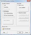
- CMS-Flow BC.jpg 399 × 448; 31 KB
- CMS-Wave Model Control.jpg 801 × 648; 74 KB
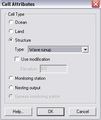
- CMS-Wave Structures dialog.bmp 276 × 328; 265 KB
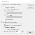
- Compute NSTPS Dialog (From Channel).PNG 370 × 367; 10 KB
- Conc isosurf w.png 1,283 × 722; 169 KB
- CoordTrans.jpg 729 × 471; 61 KB
- Cppcoordsys3.jpg 350 × 52; 6 KB
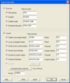
- CreateDS.jpg 519 × 615; 52 KB
- Databrowser.png 407 × 504; 33 KB
- Dataset Color Options SE.jpg 597 × 496; 50 KB
- Define MA Data Dialog WMS.PNG 422 × 429; 9 KB
- Del criterion.png 462 × 256; 5 KB
- DisplayMaterials.png 733 × 573; 20 KB
- DisplayUTEXAS.jpg 729 × 579; 74 KB
- EditTR20ParametersQuick.jpg 484 × 263; 38 KB
- EnableWizard.jpg 434 × 160; 20 KB
- EnableWizard1.jpg 434 × 160; 20 KB
- EnableWizard2.jpg 434 × 160; 21 KB
- Error.png 225 × 81; 998 bytes
- Example.jpg 314 × 385; 29 KB
- Featstamp.png 550 × 600; 310 KB
- Femwater.jpg 512 × 344; 51 KB
- FESWMS Nodestring BC.jpg 451 × 470; 29 KB
- Filter Arc Segments Tool.jpg 285 × 222; 15 KB
- Filter Arcs Tool.jpg 285 × 222; 15 KB
- Flux calib.jpg 409 × 193; 31 KB
- Generate Spectra.jpg 666 × 582; 47 KB
- Generic Model Interface.jpg 1,510 × 1,059; 202 KB
- GIS items in WMS.png 739 × 486; 486 KB
- GIS SelectData.png 507 × 340; 24 KB
- Gms toolbar map.png 288 × 16; 5 KB
- GmsBannerR.png 308 × 68; 3 KB
- Graphics window.jpg 2,236 × 1,736; 158 KB
- GridGenerator.png 288 × 152; 11 KB
- GSDAImage041.png 255 × 64; 10 KB
- GSDAImage042.png 138 × 101; 4 KB
- GSSHA Lakes and Wetlands.jpg 486 × 439; 44 KB
- GsshaDepthVaryingRoughnessIndexMap.png 759 × 420; 23 KB
- GsshaDepthVaryingRoughnessJobControl.png 755 × 360; 32 KB
- GsshaInsetModelLinkToChildXY.png 682 × 439; 22 KB
- GsshaInsetModelModelLinkageOutput.png 585 × 309; 14 KB
- GsshaInterface.png 1,680 × 1,050; 679 KB
- GsshaLakeOptions.png 407 × 436; 20 KB
- GsshaOverlandFlowBcExample.png 922 × 608; 29 KB
- GsshaOverlandFlowBcRatingCurves.png 585 × 308; 18 KB
- GsshaOverlandOutput.png 585 × 309; 16 KB
- GsshaPipeArcProperties.png 881 × 309; 61 KB
- GsshaPipePointProperties.png 749 × 309; 51 KB
- GsshaStormDrainAdverseSlopeFig1.png 811 × 139; 7 KB
- GsshaStormDrainAdverseSlopeFig2.png 876 × 353; 17 KB
- GsshaStormDrainElevationInterpFig1.png 521 × 437; 24 KB
- GsshaStormDrainElevationInterpFig2.png 513 × 673; 30 KB
- GsshaStormDrainElevationInterpFig3.png 513 × 673; 27 KB
- GsshaStormDrainHydrographsFig1.png 960 × 309; 14 KB
- GsshaStormDrainHydrographsFig2.png 934 × 470; 36 KB
- GsshaStormDrainHydrographsFig3.png 1,680 × 1,050; 117 KB
- GsshaStormDrainIdentifyNodesFig1.png 790 × 585; 43 KB
- GsshaStormDrainPipeNodeParamsFig1.png 934 × 470; 36 KB
- GsshaStormDrainRedistributeFig1.png 433 × 495; 23 KB
- GsshaStormDrainRedistributeFig2.png 327 × 451; 13 KB
- GsshaStormDrainRedistributeFig3.png 577 × 561; 35 KB
- GSSHAStreamIndexMap.jpg 364 × 409; 33 KB
- HEC1OutputControlDialog.png 583 × 387; 36 KB
- HMSjobcontrol.png 592 × 436; 18 KB
- Hy8.png 1,034 × 697; 85 KB
- HY8Arch High Profile.JPG 559 × 105; 25 KB
- HY8Arch Low Profile Table.JPG 560 × 107; 26 KB
- HY8Arch Table.JPG 559 × 106; 27 KB
- HY8fig10-1riprap-plan-new text.jpg 456 × 248; 22 KB
- HY8fig10-1riprap-profile-new text.jpg 651 × 278; 31 KB
- HY8fig11-4 (box drop).jpg 420 × 482; 25 KB
- HY8fig9-11 hook trap (rev).jpg 550 × 364; 13 KB
- HY8fig9-12hooktrap-hor (rev).jpg 635 × 373; 21 KB
- HY8fig9-8b&w.jpg 686 × 576; 42 KB
- HY8fig9-8hook (rev).jpg 533 × 337; 11 KB
- HY8image41.jpg 470 × 420; 48 KB
- HY8Irregular Channel(SMALL).JPG 259 × 199; 4 KB
- HY8Poly Table 1.JPG 652 × 190; 58 KB
- HY8Poly Table 2.JPG 695 × 122; 39 KB
- HY8Poly Table 3.JPG 657 × 138; 42 KB
- HY8Polynomial PipeArch.JPG 649 × 274; 84 KB
- HY8User Defined Table.JPG 560 × 106; 27 KB
- HYDRO AS-2D BCparameters.jpg 365 × 284; 35 KB
- HYDRO AS-2D GlobalParam.jpg 440 × 350; 40 KB
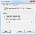
- Import Spectra.jpg 312 × 303; 18 KB
- ImportFromWeb-WebServiceOptions.png 508 × 429; 27 KB
- LayoutSelectMenu.jpg 170 × 195; 6 KB
- Lidar load Options.png 712 × 569; 33 KB
- LTEA1.jpg 577 × 340; 38 KB
- LTEA2.jpg 577 × 340; 52 KB
- LTEA3.jpg 577 × 340; 36 KB
- LTEA4.jpg 577 × 340; 36 KB
- Manhole.jpg 337 × 248; 21 KB
- MergeRasterCellSize.jpg 288 × 157; 15 KB
- MODFLOW-MNWIpackage.jpg 448 × 176; 34 KB
- MODFLOW-SUB-Delay.jpg 711 × 487; 134 KB
- MODFLOW6-duplicate.png 634 × 582; 71 KB
- MODFLOW6-runall.png 574 × 360; 44 KB
- Mp3duTime.png 446 × 175; 17 KB
- MWBM Wizard dialog - Read Existing Model.png 679 × 514; 42 KB
- NFF 1.jpg 400 × 515; 40 KB
- NodeBC.JPG 720 × 450; 36 KB
- NutrientsJobControl.jpg 765 × 352; 79 KB
- PatternPicker.png 272 × 303; 9 KB
- PipeDataProperties.jpg 363 × 428; 32 KB
- PreferencesSEAWAT.jpg 619 × 511; 42 KB
- PressureFlowSimulation.jpg 395 × 312; 33 KB
- Probe manager.jpg 851 × 484; 131 KB
- Process 3D features from survey data.png 685 × 101; 9 KB
- ProfileLinesExampleA.png 1,584 × 734; 20 KB
- ProfileLinesExampleB.png 945 × 311; 13 KB
- Profileplot.png 782 × 308; 20 KB
- RasterDialog.png 567 × 431; 11 KB
- RasterTrimWarning.jpg 468 × 171; 21 KB
- RectangularPatchOptions.png 739 × 451; 27 KB
- Refine Point.jpg 274 × 225; 13 KB
- RegisterWMS.jpg 488 × 317; 44 KB
- ReportBug.jpg 385 × 527; 54 KB
- Right Click GW.jpg 541 × 394; 30 KB
- Riv profile plot.png 760 × 295; 27 KB
- River Conceptual Model.jpg 400 × 326; 17 KB
- River Reach Att.jpg 336 × 425; 25 KB
- RivhydDisplayOpts.jpg 817 × 573; 74 KB
- Rma4 material properties.jpg 650 × 465; 46 KB
- RunupPressureHeights.jpg 211 × 339; 18 KB
- SAF.pdf 0 × 0; 368 KB
- Saltlake b cropped.png 1,138 × 751; 157 KB
- Scalar to vector toolbox.png 1,000 × 618; 177 KB
- Scatter Grid frame.jpg 306 × 381; 26 KB
- SchematicDisplayByValue.png 255 × 587; 13 KB
- SelectProjection.jpg 356 × 429; 58 KB
- SmoothStreams.png 503 × 593; 20 KB
- SMS - Create New Datum dialog.png 418 × 529; 20 KB
- SMS BOUSS 2D BC.jpg 456 × 322; 22 KB
- SMS Display Opts General.jpg 817 × 611; 28 KB
- SMS Film Loop Display.jpg 451 × 418; 25 KB
- SMS Hec Ras MP.png 200 × 250; 9 KB
- SMS LayoutQuick2.jpg 717 × 352; 87 KB
- SMS MaterialProperties.jpg 659 × 469; 54 KB
- SMS Pref Images.jpg 525 × 515; 27 KB
- SMS RiverReachAtt.png 322 × 419; 13 KB
- SMS UGrid Display.png 817 × 611; 28 KB
- SMS Vector Legen Options.jpg 407 × 294; 11 KB
- Solid cutaway.jpg 507 × 377; 55 KB
- Solids.jpg 512 × 305; 26 KB
- SRHmonitorpointscoverage.jpg 229 × 194; 12 KB
- StormDrainHydroQuick.png 738 × 526; 24 KB
- Stormpath1.jpg 637 × 435; 16 KB
