Search results
From XMS Wiki
Jump to navigationJump to search
Page title matches
- Articles that contain information about dialogs in WMS. [[Category:WMS General Information|D]]120 members (35 subcategories, 53 files) - 16:20, 3 March 2014
- Files and articles related to dialogs in the GIS module [[Category:WMS GIS|Dialogs]]26 members (0 subcategories, 18 files) - 17:15, 14 December 2015
- Files and articles related to display dialogs [[Category:WMS Dialogs|Display]]24 members (0 subcategories, 16 files) - 17:15, 14 December 2015
- Files and articles related to dialogs for stochastic modeling [[Category:WMS Modeling|Stochastic]]7 members (0 subcategories, 6 files) - 16:08, 15 December 2015
- Files and articles related to preferences dialogs in WMS [[Category:WMS Dialogs|Preferences]]7 members (0 subcategories, 6 files) - 16:14, 15 December 2015
- Files and articles related to dialogs in the Map module [[Category:WMS Map|Dialogs]]38 members (0 subcategories, 27 files) - 15:37, 31 January 2017
- Files and articles related to import dialogs in WMS. [[Category:WMS File Formats]]19 members (0 subcategories, 13 files) - 15:13, 5 January 2016
- Articles and files related to dialogs in the 2D Grid Module [[Category:WMS Dialogs|2D]]4 members (0 subcategories, 2 files) - 17:14, 2 December 2016
- Articles and files related to file format dialogs in WMS [[Category:WMS File Formats]]15 members (0 subcategories, 11 files) - 14:08, 18 July 2016
Page text matches
- Files and articles related to import dialogs in WMS. [[Category:WMS File Formats]]19 members (0 subcategories, 13 files) - 15:13, 5 January 2016
- Files and articles related to projection dialogs [[Category:SMS Dialogs]]17 members (0 subcategories, 10 files) - 18:20, 22 December 2015
- Files and articles related to dialogs in the GIS module [[Category:WMS GIS|Dialogs]]26 members (0 subcategories, 18 files) - 17:15, 14 December 2015
- Files and articles related to dialogs in the Map module [[Category:WMS Map|Dialogs]]38 members (0 subcategories, 27 files) - 15:37, 31 January 2017
- Files and articles related to registration dialogs. [[Category:GMS Dialogs]]28 members (0 subcategories, 20 files) - 18:18, 14 February 2017
File:RK RD Channels Dialog.JPG WMS: RK/RD Channels Dialog [[Category: WMS Dialogs]](413 × 568 (55 KB)) - 19:43, 20 May 2020- Articles and files related to file format dialogs in WMS [[Category:WMS File Formats]]15 members (0 subcategories, 11 files) - 14:08, 18 July 2016
- Articles and files related to dialogs in the 2D Grid Module [[Category:WMS Dialogs|2D]]4 members (0 subcategories, 2 files) - 17:14, 2 December 2016
- Files and articles related to dialogs in the TIN module [[Category:GMS Dialogs]]16 members (0 subcategories, 11 files) - 15:14, 16 December 2015
File:XY SeriesEditorCurve.png [[Category:GMS Dialogs]] [[Category:SMS Dialogs]](736 × 443 (37 KB)) - 19:27, 24 January 2023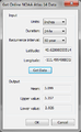
File:NoaaAtlas14Dialog.png [[Category:WMS Import Dialogs]] [[Category:WMS File Format Dialogs]](255 × 415 (23 KB)) - 15:11, 5 January 2016- Files and articles related to dialogs in the HEC-RAS model [[Category:SMS Dialogs]]9 members (0 subcategories, 6 files) - 15:02, 30 March 2017
File:XY Series Editor.png [[Category:GMS Dialogs]] [[Category:SMS Dialogs]](840 × 472 (28 KB)) - 21:50, 7 June 2022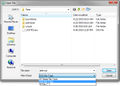
File:Open DSS.jpg [[Category:WMS File Formats]] [[Category:WMS File Format Dialogs]](629 × 452 (69 KB)) - 15:12, 5 January 2016- Articles about job control dialogs in WMS. [[Category:WMS Dialogs|Job]]29 members (0 subcategories, 19 files) - 16:12, 15 December 2016
- Files and articles related to DEM dialogs [[Category:GMS Dialogs]]18 members (0 subcategories, 10 files) - 16:52, 10 December 2015
- Articles and files related to interpolation dialogs [[Category:GMS Dialogs]]50 members (0 subcategories, 35 files) - 22:06, 8 December 2015
File:WMS GIS to Feature Objects Wizard1.png [[Category:WMS GIS]] [[Category:WMS Feature Objects]](479 × 390 (7 KB)) - 17:34, 22 June 2023
File:WMS GIS to Feature Objects Wizard2.png [[Category:WMS GIS]] [[Category:WMS Feature Objects]](479 × 390 (35 KB)) - 19:59, 5 January 2024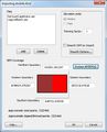
File:WMS Import ArcInfo Grid.jpg [[Category:SMS Import Dialogs]] [[Category:SMS File Format Dialogs]](442 × 547 (40 KB)) - 15:12, 5 January 2016
File:GMS Data Calculator.png Data Calculator dialog in GMS and WMS. [[Category:GMS Dialogs]](542 × 541 (64 KB)) - 18:02, 11 May 2022- Files and articles related to preferences dialogs in WMS [[Category:WMS Dialogs|Preferences]]7 members (0 subcategories, 6 files) - 16:14, 15 December 2015
File:WMScolorpallette.jpg [[Category:WMS Display Options]] [[Category:WMS Display Dialogs]](449 × 331 (15 KB)) - 16:07, 20 April 2023- {{WMS Unsupported}} Files and articles related to dialogs in the HY-12 model10 members (0 subcategories, 9 files) - 16:52, 3 January 2019
File:WMS File import wiz 1.jpg [[Category:WMS Import Dialogs]] [[Category:WMS File Format Dialogs]](644 × 411 (47 KB)) - 20:56, 22 June 2023
File:WMS File Import Wiz 2.jpg [[Category:WMS Import Dialogs]] [[Category:WMS File Format Dialogs]](658 × 417 (43 KB)) - 15:11, 5 January 2016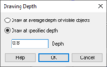
File:WMS Drawing Depth.png [[Category:WMS Feature Objects]] [[Category:WMS Map Dialogs]](260 × 165 (3 KB)) - 20:01, 22 June 2023
File:GIS to Feature Step1.png [[Category:SMS GIS Dialogs]] [[Category:GMS GIS Dialogs]](479 × 445 (13 KB)) - 18:20, 7 April 2023
File:GIS to Feature Objects Wizard -- Step 1 of 2.jpg [[Category:SMS GIS Dialogs]] [[Category:GMS GIS Dialogs]](740 × 485 (31 KB)) - 18:22, 7 April 2023- Files and articles related to display dialogs [[Category:WMS Dialogs|Display]]24 members (0 subcategories, 16 files) - 17:15, 14 December 2015
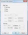
File:WMS File Import Filter Options.jpg [[Category:WMS Import Dialogs]] [[Category:WMS File Format Dialogs]](313 × 387 (22 KB)) - 15:11, 5 January 2016
File:GsshaStormDrainIdentifyNodesFig1.png [[Category:WMS Display Options]] [[Category:WMS Display Dialogs]](790 × 585 (43 KB)) - 20:50, 19 May 2023
File:AboutWMS.jpg [[Category:WMS Menus]] [[Category:WMS General Information]](540 × 374 (35 KB)) - 19:35, 23 June 2022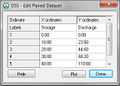
File:DSS EditPairedDataset.jpg [[Category:WMS File Formats]] [[Category:WMS File Format Dialogs]](318 × 227 (22 KB)) - 15:06, 5 January 2016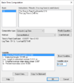
File:Basin Time Computation Dialog WMS.PNG WMS: Basin Time Computation Dialog [[Category: HEC-1 Dialogs]](457 × 511 (12 KB)) - 19:34, 20 May 2020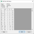
File:WMS Edit Dataset Values dialog.png ''Edit Dataset Values'' dialog in WMS. [[Category:WMS Dialogs]](401 × 403 (6 KB)) - 22:35, 4 January 2023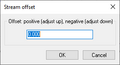
File:WMS Stream offset dialog.jpg The ''Stream offset'' dialog in WMS. [[Category:WMS Dialogs]](271 × 146 (3 KB)) - 17:48, 25 October 2022
File:WMS View Values dialog.png ''View Values'' dialog in WMS. [[Category:WMS Dialogs]](656 × 301 (19 KB)) - 18:27, 22 May 2019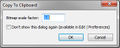
File:WMS Copy to Clipboard.jpg [[Category:WMS Dialogs]] WMS Copy To Clipboard dialog(349 × 139 (17 KB)) - 20:11, 8 April 2016
File:WMS Redistribute Vertices dialog.png ''Redistribute Vertices'' dialog in WMS. [[Category:WMS Dialogs]](337 × 469 (7 KB)) - 22:57, 15 April 2024
File:WMS Model Wrapper Dialog.png ''Model Wrapper'' dialog in WMS. [[Category:WMS Dialogs]](928 × 387 (27 KB)) - 19:22, 10 May 2019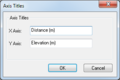
File:WMS Axis Titles dialog.png ''Axis Titles'' dialog in WMS. [[Category:WMS Dialogs]](304 × 202 (10 KB)) - 18:13, 22 May 2019
File:RegisterImage.png [[Category:GMS Dialogs]] [[Category:SMS Import Dialogs]](689 × 700 (289 KB)) - 20:11, 6 June 2023
File:RasterSmoothingOpts.jpg [[Category:SMS GIS Dialogs]] [[Category:SMS Raster Dialogs]](280 × 270 (23 KB)) - 16:15, 11 December 2015- Files and articles related to dialogs in the Hydraulic module [[Category:WMS Dialogs]]24 members (2 subcategories, 15 files) - 15:30, 18 December 2015
- Files and articles related to dialogs in the MODRAT model [[Category:WMS Dialogs]]11 members (0 subcategories, 7 files) - 16:16, 9 December 2015
- Files and articles related to dialogs in the NSS dialog [[Category:WMS Dialogs]]6 members (0 subcategories, 4 files) - 16:19, 9 December 2015
- Files and articles related to dialogs in the GSSHA model [[Category:WMS Dialogs]]145 members (0 subcategories, 113 files) - 16:08, 3 December 2015
- Files and articles related to dialogs in the SMPDBK model [[Category:WMS Dialogs]]8 members (0 subcategories, 5 files) - 16:23, 9 December 2015
- Articles and files related to dialogs in the DSS model [[Category:WMS Dialogs]]7 members (0 subcategories, 5 files) - 15:56, 18 December 2015
- Files and articles related to dialogs in the HSPF model [[Category:WMS Dialogs]]10 members (0 subcategories, 6 files) - 16:12, 9 December 2015
- Files and articles related to dialogs in the drainage module [[Category:WMS Dialogs]]8 members (0 subcategories, 7 files) - 15:25, 16 December 2015
File:WMS Drainage Feature Point Type.png [[Category:WMS Feature Objects]] [[Category:Drainage Dialogs]](221 × 216 (4 KB)) - 18:24, 22 June 2023
File:WMS Drainage Feature Polygon Type.png [[Category:WMS Feature Objects]] [[Category:Drainage Dialogs]](266 × 182 (4 KB)) - 18:25, 22 June 2023- Files and articles related to dialogs for stochastic modeling [[Category:WMS Modeling|Stochastic]]7 members (0 subcategories, 6 files) - 16:08, 15 December 2015

File:NewDSS Dataset2.jpg [[Category:WMS File Formats]] [[Category:WMS File Format Dialogs]](721 × 586 (81 KB)) - 15:07, 5 January 2016- Files and articles related to dialogs in the Orange County Rational Hydrology model [[Category:WMS Dialogs]]12 members (0 subcategories, 6 files) - 15:43, 16 December 2015
- Files and articles related to dialogs in MWBM modeling [[Category:WMS Dialogs]]18 members (1 subcategory, 16 files) - 15:46, 18 December 2015
- Articles and files related to dialogs in the Orange County Unit Hydrology model [[Category:WMS Dialogs]]11 members (0 subcategories, 6 files) - 15:36, 16 December 2015
File:WMS Units.jpg [[Category:WMS Dialogs]] WMS Units dialog(340 × 228 (21 KB)) - 20:13, 8 April 2016
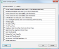
File:Data Service Options.png [[Category:WMS Import Dialogs]] [[Category:SMS Import Dialogs]](478 × 393 (116 KB)) - 16:50, 26 April 2019
File:GIS LayerProperties.png [[Category:WMS GIS]] [[Category:WMS GIS Dialogs]](642 × 441 (38 KB)) - 16:28, 11 December 2015
File:NewDSS Dataset.jpg [[Category:WMS File Formats]] [[Category:WMS File Format Dialogs]](721 × 586 (78 KB)) - 15:06, 5 January 2016
File:WMS Display Options 2D Grid.jpg [[Category:WMS 2D Grid]] [[Category:WMS Display Options]](782 × 563 (37 KB)) - 20:16, 19 May 2023
File:Basin Geometric Attributes dialog WMS.PNG WMS: Basin Geometric Attributes Dialog [[Category: WMS Dialogs]](545 × 456 (14 KB)) - 19:37, 20 May 2020
File:WMS Coverage Overlay.png [[Category:WMS Coverages]] [[Category:WMS Map Dialogs]](340 × 523 (22 KB)) - 18:55, 5 January 2024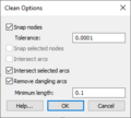
File:WMS Clean Options.png [[Category:WMS Map]] [[Category:WMS Feature Objects]](260 × 234 (7 KB)) - 20:06, 22 June 2023
File:WMS Coverage Properties.png [[Category:WMS Map]] [[Category:WMS Feature Objects]](321 × 378 (7 KB)) - 20:33, 22 June 2023
File:WMS Film Loop.png [[Category:Animation Dialogs]] [[Category:WMS General Information|S]](437 × 435 (19 KB)) - 20:25, 16 June 2022
File:AddNewSource.png [[Category:WMS Import Dialogs]] [[Category:SMS Import Dialogs]](430 × 684 (20 KB)) - 20:42, 22 March 2023
File:MODRAT Job Control.jpg [[Category:WMS Display Options]] [[Category:WMS Display Dialogs]](482 × 326 (12 KB)) - 20:41, 19 May 2023
File:WMS PlotWizard2.jpg [[Category:WMS General Information]] [[Category:WMS Dialogs]](483 × 521 (69 KB)) - 15:08, 10 January 2017
File:Map Properties.jpg [[Category:SMS GIS Dialogs]] [[Category:WMS GIS Dialogs]](487 × 594 (37 KB)) - 16:30, 11 December 2015
File:WMS XY SeriesEditor.jpg [[Category:WMS File Formats]] [[Category:WMS File Format Dialogs]](786 × 465 (97 KB)) - 15:32, 10 January 2017- Articles and files related to dialogs in the TR-20 model [[Category:WMS Dialogs]]19 members (0 subcategories, 12 files) - 15:29, 16 December 2015
- Files and articles related to dialogs in the HEC-HMS model [[Category:WMS Dialogs]]27 members (0 subcategories, 20 files) - 17:06, 4 December 2015
- Files and articles related to dialogs in the Storm Drain model [[Category:WMS Dialogs]]8 members (0 subcategories, 6 files) - 17:35, 4 December 2015
- Files and articles related to dialogs in the Rational Method model. [[Category:WMS Dialogs]]6 members (0 subcategories, 3 files) - 16:33, 21 December 2015
- Articles and files related to dialogs in the TR-55 model [[Category:WMS Dialogs]]8 members (0 subcategories, 2 files) - 18:17, 22 December 2015
- Files and articles related to dialogs in the HEC-1 model [[Category:WMS Dialogs]]30 members (0 subcategories, 25 files) - 16:08, 9 December 2015
File:Add Data Dialog.jpg [[Category:SMS GIS Dialogs]] [[Category:GMS GIS Dialogs]](507 × 340 (47 KB)) - 16:41, 11 December 2015
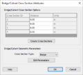
File:WMS - Bridge Culvert Parameters dialog.png The ''Bridge/Culvert Parameters'' dialog in WMS. [[Category:WMS Map]](458 × 497 (18 KB)) - 18:54, 4 January 2024
File:WMS - CsDb Topo Management dialog.png [[Category:WMS Map]] [[Category:WMS Map Dialogs]](298 × 347 (4 KB)) - 18:55, 4 January 2024
File:WMS - Line Property Types dialog.png [[Category:WMS Map]] [[Category:WMS Map Dialogs]](542 × 308 (6 KB)) - 18:57, 4 January 2024
File:WMS - Point Property Types dialog.png [[Category:WMS Map]] [[Category:WMS Map Dialogs]](542 × 308 (6 KB)) - 19:02, 4 January 2024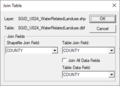
File:Join Table.png [[Category:SMS GIS Dialogs]] [[Category:WMS GIS Dialogs]](338 × 243 (9 KB)) - 15:23, 30 September 2019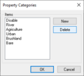
File:WMS - Property Categories dialog.png [[Category:WMS Map]] [[Category:WMS Map Dialogs]](262 × 235 (4 KB)) - 19:01, 4 January 2024
File:WMS Customization dialog General tab.png The ''General'' tab in the WMS ''Customization...'' dialog. [[Category:WMS Dialogs]](582 × 403 (34 KB)) - 22:36, 17 April 2019
File:WMS Customization dialog Axis tab.png The ''Axis'' tab in the WMS ''Customization...'' dialog. [[Category:WMS Dialogs]](582 × 403 (29 KB)) - 22:37, 17 April 2019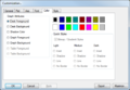
File:WMS Customization dialog Color tab.png The ''Color'' tab in the WMS ''Customization...'' dialog. [[Category:WMS Dialogs]](582 × 403 (33 KB)) - 22:38, 17 April 2019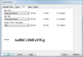
File:WMS Customization dialog Font tab.png The ''Font'' tab in the WMS ''Customization...'' dialog. [[Category:WMS Dialogs]](582 × 403 (30 KB)) - 23:10, 17 April 2019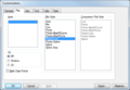
File:WMS Customization dialog Plot tab.png The ''Plot'' tab in the WMS ''Customization...'' dialog. [[Category:WMS Dialogs]](582 × 403 (29 KB)) - 22:38, 17 April 2019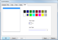
File:WMS Customization dialog Style tab.png The ''Style'' tab in the WMS ''Customization...'' dialog. [[Category:WMS Dialogs]](582 × 403 (20 KB)) - 22:39, 17 April 2019
File:WMS Exporting Plot Data.jpg The ''Exporting''' dialog in WMS. Used when exporting a plot. [[Category:WMS Dialogs]](511 × 314 (26 KB)) - 22:21, 17 April 2019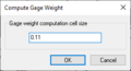
File:ComputeGageWeight.png WMS Compute Gage Weight dialog [[Category:WMS Map Dialogs]](271 × 146 (3 KB)) - 19:46, 5 January 2024- Articles that contain information about dialogs in WMS. [[Category:WMS General Information|D]]120 members (35 subcategories, 53 files) - 16:20, 3 March 2014
File:WMS ModelSteering.jpg [[Category:WMS Modeling]] [[Category:WMS Stochastic Dialogs]](426 × 496 (55 KB)) - 16:07, 15 December 2015
File:DSS FileEditor.jpg [[Category:WMS File Format Dialogs]] [[Category:WMS File Formats]](604 × 444 (82 KB)) - 15:07, 5 January 2016
File:TIN OptionsDialog.jpg [[Category:TIN Dialogs]] [[Category:WMS Display Dialogs]](531 × 371 (50 KB)) - 15:30, 16 May 2019
File:WelcomeToWMS.jpg [[Category:WMS General Information]] [[Category:Registration Dialogs]](525 × 191 (28 KB)) - 16:13, 23 December 2015
File:LandUseAtts.png [[Category:WMS Map]] [[Category:WMS Coverages]](652 × 581 (54 KB)) - 18:44, 5 January 2024
File:WMS Create Grid.jpg [[Category:WMS Map]] [[Category:WMS Feature Objects]](356 × 385 (8 KB)) - 16:16, 21 April 2023- Files and articles related to the WMS to HY-8 Modeling Wizard [[Category:WMS To HY8]]63 members (0 subcategories, 35 files) - 16:09, 15 December 2015
File:WMS - BridgeCulvert Cross Section Attributes dialog.png The ''Bridge/Culvert Cross Section Attributes'' dialog in WMS. [[Category:WMS Map]](407 × 367 (12 KB)) - 20:48, 22 June 2023
File:WMSGeodatabase001.png [[Category:WMS GIS]] [[Category:WMS Feature Objects]](192 × 224 (18 KB)) - 14:51, 6 October 2017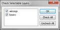
File:GISchecklayers.jpg [[Category:WMS GIS Dialogs]] [[Category:GMS GIS Dialogs]](276 × 140 (12 KB)) - 16:12, 15 December 2015
File:WMS Open.jpg [[Category:WMS General Information]] [[Category:WMS Import Dialogs]](565 × 683 (41 KB)) - 20:18, 22 June 2023
File:WMSregister1.jpg Register WMS dialog prior to activation. [[Category:Registration Dialogs]](297 × 487 (37 KB)) - 16:13, 23 December 2015
File:WMS - River Cross Section Attributes dialog.png [[Category:WMS Map]] [[Category:WMS Map Dialogs]](352 × 537 (13 KB)) - 20:27, 22 June 2023- Files and articles about dialogs in the CE-QUAL-W2 model [[Category:WMS Dialogs]]10 members (0 subcategories, 7 files) - 17:28, 4 December 2015
File:ImportFromWeb-WebServiceOptions.png [[Category:WMS General Information]] [[Category:WMS Import Dialogs]](508 × 429 (27 KB)) - 15:24, 16 May 2019
File:WMS PlotWizard3.png [[Category:WMS General Information]] [[Category:WMS Dialogs]](483 × 521 (26 KB)) - 15:07, 10 January 2017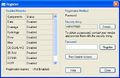
File:RegisterWMS.jpg [[Category:WMS General Information]] [[Category:Registration Dialogs]](488 × 317 (44 KB)) - 15:30, 16 May 2019
File:RegisterWMSwindow.jpg [[Category:WMS Menus]] [[Category:WMS General Information]](297 × 487 (60 KB)) - 20:29, 8 April 2016
File:WMSnewpalette.jpg [[Category:WMS Display Options]] [[Category:WMS Display Dialogs]](289 × 221 (5 KB)) - 18:09, 22 May 2023
File:WMS Basin Time Computation.png [[Category:WMS Dialogs]] [[Category:WMS Basins]](457 × 511 (8 KB)) - 16:27, 14 July 2020
File:WMSGridOpts.png [[Category:WMS 2D Grid]] [[Category:WMS 2D Grid Dialogs]](260 × 394 (8 KB)) - 20:58, 29 June 2023
File:WMS PropertiesWindow1.png [[Category:WMS Quick Tour]] [[Category:WMS General Information]](221 × 180 (3 KB)) - 14:55, 4 May 2016
File:TimeComputationsArcAttributes .png [[Category:WMS Map]] [[Category:WMS Map Dialogs]](380 × 450 (22 KB)) - 20:37, 4 January 2024
File:GIS Select by Location.png [[Category:WMS GIS]] [[Category:WMS GIS Dialogs]](423 × 384 (17 KB)) - 16:28, 11 December 2015
File:ColorPicker.png [[Category:WMS Display Options]] [[Category:WMS Display Dialogs]](148 × 125 (2 KB)) - 20:06, 19 May 2023
File:TimeComputationsArcAttributes2.png [[Category:WMS Map]] [[Category:WMS Map Dialogs]](380 × 450 (23 KB)) - 20:33, 4 January 2024
File:WMS85WebServices.png [[Category:WMS Dialogs]](312 × 352 (35 KB)) - 18:23, 12 May 2014
File:GISidentify.jpg [[Category:WMS GIS Dialogs]] [[Category:GMS GIS Dialogs]](295 × 191 (18 KB)) - 16:11, 2 March 2017
File:HydrologicModelingWizardCreate2DGrid.jpg [[Category:WMS Modeling]] [[Category:WMS Modeling Wizard Dialog]](679 × 514 (88 KB)) - 17:37, 8 April 2019
File:NcdcRainfallStationWizard.png [[Category:WMS Dialogs]](555 × 433 (39 KB)) - 15:26, 2 July 2018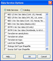
File:WebServices.png [[Category:WMS Dialogs]](302 × 346 (13 KB)) - 18:31, 1 June 2018
File:RiverReachAtt.png [[Category:WMS Map Dialogs]] [[Category:WMS Map]](319 × 406 (7 KB)) - 18:46, 4 January 2024
File:SoilAtts.png [[Category:WMS Map]] [[Category:WMS Map Dialogs]](652 × 528 (13 KB)) - 18:45, 5 January 2024
File:WMSsymbolatt.jpg [[Category:WMS Display Options]] [[Category:WMS Display Dialogs]](424 × 234 (5 KB)) - 16:06, 20 April 2023
File:WMSlineproperties.jpg [[Category:WMS Display Options]] [[Category:WMS Display Dialogs]](212 × 178 (5 KB)) - 16:06, 20 April 2023
File:PlotWindowExample.jpg [[Category:WMS General Information]] [[Category:WMS Dialogs]](592 × 494 (79 KB)) - 15:30, 20 February 2017
File:CurbGutterCalculator.jpg [[Category:WMS Dialogs]](456 × 554 (62 KB)) - 14:36, 5 June 2018
File:ExtractFeatures WMS.png [[Category:WMS Map Dialogs]](383 × 409 (15 KB)) - 19:16, 27 May 2021
File:Sediment.png [[Category:WMS Dialogs]](1,146 × 585 (456 KB)) - 18:31, 1 June 2018
File:Dialog Hydrograph Table.png [[Category:WMS Dialogs]](304 × 469 (15 KB)) - 15:46, 11 January 2016
File:WMS Edit Basin Polygon Att.png [[Category:WMS Feature Objects]] [[Category:Drainage Dialogs]](512 × 139 (6 KB)) - 18:26, 22 June 2023
File:WMSfont.jpg [[Category:WMS Display Options]] [[Category:WMS Display Dialogs]](433 × 351 (15 KB)) - 16:07, 20 April 2023
File:GIS Selection Options.png [[Category:WMS GIS Dialogs]] [[Category:WMS GIS]](396 × 342 (15 KB)) - 16:28, 11 December 2015
File:WMS Reclassify Index Map Dialog.png ''Reclassify Index Map'' dialog in WMS. [[Category:GSSHA Dialogs]](196 × 299 (4 KB)) - 18:59, 25 October 2022
File:FloodDepthCoverage.png [[Category:WMS Map]] [[Category:WMS Map Dialogs]](200 × 520 (14 KB)) - 19:04, 5 January 2024
File:SelectOnlineSource.png [[Category:WMS Import Dialogs]] [[Category:SMS Import Dialogs]](364 × 366 (14 KB)) - 16:44, 26 April 2019
File:ScholasticRunParameters2.png [[Category:Hydraulic Dialogs]] [[Category:WMS Stochastic Dialogs]](556 × 588 (15 KB)) - 20:17, 23 June 2023
File:GIS FeatureToGeodatabase.png [[Category:WMS GIS]] [[Category:WMS Feature Objects]](493 × 396 (14 KB)) - 16:28, 11 December 2015
File:JoinSsurgoData.png [[Category:WMS GIS Dialogs]] [[Category:WMS GIS]](849 × 550 (229 KB)) - 15:27, 31 May 2018
File:DataServiceOptions.png [[Category:WMS Import Dialogs]](478 × 393 (123 KB)) - 21:02, 29 June 2023
File:WMS Detention Basin Rating Curve dialog.png The ''Detention Basin Rating Curve'' dialog in WMS. [[Category:GSSHA Dialogs]](370 × 394 (7 KB)) - 17:43, 25 October 2022
File:WMS IDF Curve.jpg [[Category:WMS Parameters]] [[Category:Storm Drain Dialogs]](360 × 132 (10 KB)) - 16:46, 15 December 2016
File:WMSregistration w license.jpg Register WMS using a vendor provided code. [[Category:WMS General Information]](487 × 144 (17 KB)) - 16:11, 23 December 2015
File:WMSChannelCalculations.png WMS Channel Calculations: This dialog provides an interface for the user to ma [[Category:WMS Dialogs]](207 × 540 (16 KB)) - 14:31, 11 April 2016
File:GISquery wizard.png [[Category:WMS GIS Dialogs]] [[Category:WMS GIS]](487 × 352 (21 KB)) - 16:29, 11 December 2015
File:GISquery wizard2.png [[Category:WMS GIS Dialogs]] [[Category:WMS GIS]](487 × 352 (20 KB)) - 16:30, 11 December 2015
File:WMS Compute GIS Attributes.png [[Category:WMS GIS]] [[Category:WMS GIS Dialogs]](481 × 568 (11 KB)) - 16:44, 13 June 2022
File:GISquery wizard3.png [[Category:WMS GIS Dialogs]] [[Category:WMS GIS]](487 × 352 (22 KB)) - 16:30, 11 December 2015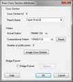
File:RiverCrossSectionAtt.jpg [[Category:WMS Map]] [[Category:WMS Map Dialogs]](348 × 391 (32 KB)) - 14:42, 18 September 2017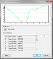
File:AssignCrossSectionProfile.jpg [[Category:WMS Map]] [[Category:WMS Map Dialogs]](445 × 490 (49 KB)) - 14:43, 18 September 2017
File:DEMcontouropts.jpg [[Category:WMS Display Options]] [[Category:WMS Display Dialogs]](535 × 424 (17 KB)) - 20:14, 19 May 2023
File:ContourLegendOpts.jpg [[Category:WMS Display Options]] [[Category:WMS Display Dialogs]](287 × 458 (8 KB)) - 20:08, 19 May 2023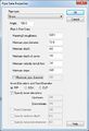
File:WMS Pipe Data Properties.jpg [[Category:WMS Parameters]] [[Category:Storm Drain Dialogs]](373 × 548 (38 KB)) - 16:46, 15 December 2016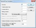
File:WMS Pressure flow Sim.jpg [[Category:WMS Parameters]] [[Category:Storm Drain Dialogs]](405 × 314 (26 KB)) - 16:46, 15 December 2016
File:StochasticHEC-1.jpg [[Category:WMS Modeling]] [[Category:WMS Stochastic Dialogs]](526 × 530 (76 KB)) - 16:07, 15 December 2015
File:StochasticRunParameters3.jpg [[Category:WMS Modeling]] [[Category:WMS Stochastic Dialogs]](570 × 594 (66 KB)) - 16:07, 15 December 2015
File:WMS - Assign Cross Section dialog.png [[Category:WMS Map]] [[Category:WMS Map Dialogs]](486 × 611 (22 KB)) - 20:19, 22 June 2023
File:WMScoloropts.jpg [[Category:WMS Display Options]] [[Category:WMS Display Dialogs]](398 × 471 (14 KB)) - 20:31, 19 May 2023
File:DatasetZonalClassification1.png [[Category:WMS Dialogs]](586 × 456 (10 KB)) - 22:59, 4 January 2023
File:WMS GSSHA Snowmelt Options Dialog.png ''GSSHA Snowmelt Options'' dialog in WMS. [[Category:GSSHA Dialogs]](627 × 452 (16 KB)) - 15:29, 16 May 2023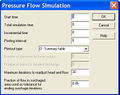
File:PressureFlowSimulation.jpg [[Category:WMS Dialogs]](395 × 312 (33 KB)) - 15:38, 2 July 2018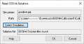
File:WMS Read GSSHA Solution dialog.png ''Read GSSHA Solution'' dialog in WMS. [[Category:GSSHA Dialogs]](364 × 191 (5 KB)) - 22:03, 17 October 2022
File:PipeDataProperties.jpg [[Category:WMS Dialogs]](363 × 428 (32 KB)) - 15:38, 2 July 2018
File:WMS Save GSSHA Group dialog.png ''Save GSSHA Group'' dialog in WMS. [[Category:GSSHA Dialogs]](338 × 328 (9 KB)) - 19:47, 25 October 2022
File:WMS GSSHA Calibration Output dialog.png ''GSSHA Calibration Output'' dialog in WMS. [[Category:GSSHA Dialogs]](431 × 625 (48 KB)) - 18:18, 21 May 2019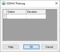
File:WMS GSSHA Thalweg dialog.png ''GSSHA Thalweg'' dialog in WMS. [[Category:GSSHA Dialogs]](274 × 238 (4 KB)) - 18:33, 3 November 2022
File:ModifyEquations.png [[Category:WMS Dialogs]](407 × 520 (13 KB)) - 19:26, 29 March 2024
File:WMS Weir Calculator.jpg [[Category:WMS Dialogs]](403 × 235 (20 KB)) - 14:38, 11 April 2016
File:ChannelCalculations.jpg [[Category:WMS Dialogs]](698 × 395 (130 KB)) - 14:31, 5 June 2018
File:WMS Dataset Info.png [[Category:WMS Dialogs]](578 × 422 (15 KB)) - 22:38, 4 January 2023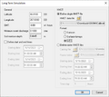
File:Long Term Simulation Dialog.png GSSHA ''Long Term Simulation'' dialog in WMS. [[Category:GSSHA Dialogs]](545 × 487 (21 KB)) - 17:54, 16 May 2023
File:WMS GSSHA Select File Format dialog.png GSSHA ''Select File Format'' dialog in WMS. [[Category:GSSHA Dialogs]](346 × 120 (5 KB)) - 19:03, 25 October 2022
File:TimeTravelComputation.jpg [[Category:WMS Dialogs]](526 × 287 (31 KB)) - 18:46, 23 April 2015
File:WMS GSSHA Import Index Map dialog.png GSSHA ''Import Index Map'' dialog in WMS. [[Category:GSSHA Dialogs]](557 × 417 (31 KB)) - 19:02, 25 October 2022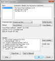
File:BasinTimeComputation.jpg [[Category:WMS Dialogs]](471 × 517 (57 KB)) - 15:06, 2 April 2015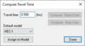
File:ComputeTravelTime.png [[Category:WMS Dialogs]](304 × 164 (4 KB)) - 19:27, 29 March 2024
File:WMSChannelCalculator.png [[Category:WMS Dialogs]](538 × 429 (18 KB)) - 21:39, 19 January 2024
File:DatasetZonalClassificationDisplay1.png [[Category:WMS Dialogs]](541 × 346 (8 KB)) - 23:02, 4 January 2023
File:WMS GSSHA Storm Tile Drain Dialog.png The GSSHA ''Storm/tile drain'' dialog in WMS. [[Category:GSSHA Dialogs]](319 × 227 (5 KB)) - 16:53, 15 May 2023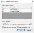
File:WMS Save and Run GSSHA Group dialog.png ''Save and Run GSSHA Group'' dialog in WMS. [[Category:GSSHA Dialogs]](338 × 328 (11 KB)) - 19:49, 25 October 2022
File:Data Calculator.png [[Category:WMS Dialogs]](545 × 502 (13 KB)) - 22:30, 4 January 2023
File:WMS TransformTIN.png WMS Transform TIN dialog [[Category:TIN Dialogs]](437 × 299 (7 KB)) - 19:56, 3 January 2020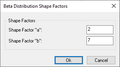
File:WMS GSSHA Beta Distribution Shape Factors Dialog.png The GSSHA ''Beta Distribution Shape Factors'' dialog in WMS. [[Category:GSSHA Dialogs]](308 × 172 (3 KB)) - 19:13, 16 May 2023
File:HydrographStationPlot.jpg [[Category:WMS Modeling]] [[Category:WMS Stochastic Dialogs]](481 × 413 (68 KB)) - 16:07, 15 December 2015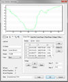
File:CrossSectionAtt.jpg [[Category:Hydraulic Dialogs]] The ''Cross Section Attributes'' dialog in WMS. See also [[:File:WMS - Cross Section Attributes dialog.png]].(552 × 665 (87 KB)) - 21:24, 13 June 2018
File:EnableWizard1.jpg [[Category:Registration Dialogs]] [[Category:WMS General Information]](434 × 160 (20 KB)) - 15:29, 16 May 2019
File:EnableWizard2.jpg [[Category:Registration Dialogs]] [[Category:WMS General Information]](434 × 160 (21 KB)) - 15:29, 16 May 2019
File:EnableWizard.jpg [[Category:Registration Dialogs]] [[Category:WMS General Information]](434 × 160 (20 KB)) - 15:29, 16 May 2019
File:WMS Display Opts Drawing Grid.jpg [[Category:WMS Display Options]] [[Category:WMS Display Dialogs]](782 × 563 (33 KB)) - 20:17, 19 May 2023
File:WMS GSSHA Hydraulic Structures dialog culvert.png The ''GSSHA Hydraulic Structures'' dialog in WMS with "Culverts" selected. [[Category:GSSHA Dialogs|Hydraulic]](403 × 440 (9 KB)) - 18:04, 25 October 2022
File:WMS GSSHA index map file export File Formats dialog.png GSSHA index map file export ''File Formats'' dialog in WMS. [[Category:GSSHA Dialogs]](254 × 131 (3 KB)) - 19:01, 25 October 2022
File:WMS GSSHA Hydraulic Structures dialog weir.png The ''GSSHA Hydraulic Structures'' dialog in WMS with "Weir" selected. [[Category:GSSHA Dialogs|Hydraulic]](403 × 440 (9 KB)) - 18:03, 25 October 2022
File:WMS GSSHA Hydraulic Structures dialog detention basin.png The ''GSSHA Hydraulic Structures'' dialog in WMS with "Detention Basin" selected. [[Category:GSSHA Dialogs|Hydraulic]](403 × 440 (10 KB)) - 18:01, 25 October 2022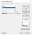
File:WMS GSSHA Hydraulic Structures dialog rating curve.png The ''GSSHA Hydraulic Structures'' dialog in WMS with "Rating Curve" selected. [[Category:GSSHA Dialogs|Hydraulic]](403 × 440 (8 KB)) - 18:06, 25 October 2022
File:WMS GSSHA Hydraulic Structures dialog rule curve.png The ''GSSHA Hydraulic Structures'' dialog in WMS with "Rule Curve" selected. [[Category:GSSHA Dialogs|Hydraulic]](403 × 440 (8 KB)) - 18:07, 25 October 2022
File:WMS GSSHA Hydraulic Structures dialog sched discharge.png The ''GSSHA Hydraulic Structures'' dialog in WMS with "Sched. Discharge" selected. [[Category:GSSHA Dialogs|Hydraulic]](403 × 440 (8 KB)) - 18:08, 25 October 2022
File:TimeSeriesCalculator.png [[Category:WMS Dialogs]](488 × 535 (48 KB)) - 16:25, 8 December 2015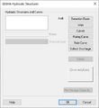
File:WMS GSSHA Hydraulic Structures dialog.png The ''GSSHA Hydraulic Structures'' dialog in WMS. [[Category:GSSHA Dialogs|Hydraulic]](403 × 440 (7 KB)) - 17:56, 25 October 2022
File:WMSdisplayopts.jpg [[Category:WMS Display Options]] [[Category:WMS Display Dialogs]](782 × 563 (39 KB)) - 16:06, 20 April 2023
File:WMS Merge TINs.png [[Category:TIN Dialogs]] WMS Merge TINs dialog(439 × 417 (7 KB)) - 16:40, 7 January 2020
File:WMS Confirm deletion.jpg [[Category:WMS Preferences Dialogs]](497 × 171 (22 KB)) - 19:57, 8 April 2016
File:WMS Edit Stream Arc Attributes.png [[Category:WMS Feature Objects]] [[Category:Drainage Dialogs]](512 × 217 (13 KB)) - 18:28, 22 June 2023
File:Dialog GSSHA Precipitation - Nexrad radar.png ''GSSHA Precipitation'' dialog showing "Nexrad Radar" options in WMS. [[Category:GSSHA Dialogs]](281 × 328 (7 KB)) - 19:16, 8 November 2022
File:Edit HEC-1 Parameters.png [[Category:WMS Parameters]] [[Category:HEC-1 Dialogs]](583 × 502 (14 KB)) - 22:10, 13 July 2020
File:GetDataDialog.png [[Category:WMS Dialogs]](603 × 1,010 (217 KB)) - 18:53, 30 April 2014
File:WMS Pref Project Explorer.png [[Category:WMS Preferences Dialogs]](715 × 528 (9 KB)) - 19:42, 23 June 2023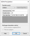
File:Dialog GSSHA Precipitation.png ''GSSHA Precipitation'' dialog showing "Uniform" options in WMS. [[Category:GSSHA Dialogs]](281 × 328 (6 KB)) - 19:11, 8 November 2022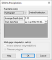
File:Dialog GSSHA Precipitation - hyetograph.png ''GSSHA Precipitation'' dialog showing "Hyetograph" options in WMS. [[Category:GSSHA Dialogs]](281 × 328 (6 KB)) - 19:15, 8 November 2022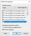
File:Dialog GSSHA Precipitation - gage.png ''GSSHA Precipitation'' dialog showing "Gage" options in WMS. [[Category:GSSHA Dialogs]](281 × 328 (7 KB)) - 19:14, 8 November 2022- ...l of the modules. The commands in the ''Help'' menu are to assist in using WMS. ; WMS Help : Accesses the [[WMS:WMS|WMS Wiki]] if an internet connection is available.1 KB (192 words) - 16:52, 16 January 2017
File:WMS Materials.jpg [[Category:WMS Dialogs]](499 × 413 (35 KB)) - 18:54, 2 December 2016
File:HEC1JobControlDialog.png [[Category:HEC-1 Dialogs]] [[Category:OC Unit Dialogs]](421 × 554 (12 KB)) - 16:18, 14 July 2020
File:WMS Pref General.jpg [[Category:WMS Preferences Dialogs]](729 × 482 (61 KB)) - 19:56, 8 April 2016
File:WMS Tin Options.png [[Category:TIN Dialogs]] [[Category:WMS Quick Tour]](527 × 367 (11 KB)) - 16:36, 7 January 2020
File:WMS Pref Graphics.jpg [[Category:WMS Preferences Dialogs]](729 × 482 (53 KB)) - 19:57, 8 April 2016
File:WMS Pref Files.png [[Category:WMS Preferences Dialogs]](715 × 528 (60 KB)) - 19:40, 23 June 2023- ...er formats, as GIS data layers in WMS. These data can then be converted to WMS feature objects in map coverages. * [[WMS:Introduction to ArcObjects#Enabling ArcObjects|Enabling ArcObjects]]772 bytes (115 words) - 15:42, 2 February 2016
File:OC Reational Job control.png [[Category:WMS Parameters]] [[Category:OC Rational Dialogs]](263 × 510 (8 KB)) - 18:29, 9 June 2023
File:WMS Gages.png [[Category:WMS Dialogs]](451 × 476 (9 KB)) - 18:44, 29 March 2024
File:Edit DEM Elevations Interpolate.png [[Category:DEM Dialogs]] [[Category:WMS Plot]](526 × 425 (22 KB)) - 14:56, 15 September 2020
File:WMS Pref Image Pref.jpg [[Category:WMS Preferences Dialogs]](729 × 482 (44 KB)) - 19:57, 8 April 2016
File:WMS FHWA Storm Drain JC.jpg [[Category:WMS Parameters]] [[Category:Storm Drain Dialogs]](502 × 254 (26 KB)) - 16:47, 15 December 2016
File:WMS Edit Drainage Point Att.png [[Category:WMS Feature Objects]] [[Category:Drainage Dialogs]](494 × 193 (11 KB)) - 18:27, 22 June 2023
File:WMS - Cross Section Attributes dialog.png [[Category:Hydraulic Dialogs]] The ''Cross Section Attributes'' dialog in WMS. See also [[:File:CrossSectionAtt.jpg]].(538 × 659 (36 KB)) - 19:58, 4 January 2024
File:MWBM Wizard dialog - Define Land Use and Soil Data.png The "Define Land Use and Soil Data" page of the [[WMS:MWBM Wizard|''MWBM Wizard'' dialog]]. [[Category:MWBM Dialogs]](679 × 514 (36 KB)) - 20:01, 20 March 2019
File:WMSregistration w evaluation.jpg [[Category:WMS General Information]] [[Category:Registration Dialogs]](488 × 143 (17 KB)) - 16:11, 23 December 2015
File:StochasticRunParameters.jpg [[Category:WMS Stochastic Dialogs]](570 × 594 (73 KB)) - 16:08, 15 December 2015
File:MWBM Wizard dialog - Define Precipitation.png The "Define Precipitation" (Rainfall) page of the [[WMS:MWBM Wizard|''MWBM Wizard'' dialog]]. [[Category:MWBM Dialogs]](665 × 508 (17 KB)) - 21:26, 29 June 2023
File:MWBM Wizard dialog - Create 2D Grid.png The "Create 2D Grid" page of the [[WMS:MWBM Wizard|''MWBM Wizard'' dialog]]. [[Category:MWBM Dialogs]](665 × 508 (30 KB)) - 20:35, 30 June 2023
File:MWBM Wizard dialog - Erosion-Deposition Maps.png The "Erosion/Deposition Maps" page of the [[WMS:MWBM Wizard|''MWBM Wizard'' dialog]]. [[Category:MWBM Dialogs]](679 × 514 (36 KB)) - 20:05, 20 March 2019
File:WMS GSSHA SAC-SMA Model Dialog.png The [[WMS:GSSHA Job Control#SAC-SMA Model Dialog|GSSHA ''SAC_SMA Model'' dialog]]. [[Category:GSSHA Dialogs]](403 × 396 (7 KB)) - 21:08, 24 October 2022
File:MWBM Wizard dialog - Index Maps.png The "Index Maps" page of the [[WMS:MWBM Wizard|''MWBM Wizard'' dialog]]. [[Category:MWBM Dialogs]](679 × 514 (31 KB)) - 20:02, 20 March 2019
File:MWBM Wizard dialog - Embankment Locations.png The "Embankment Locations" page of the [[WMS:MWBM Wizard|''MWBM Wizard'' dialog]]. [[Category:MWBM Dialogs]](679 × 514 (34 KB)) - 20:02, 20 March 2019
File:MWBM Wizard dialog - Define Model Changes.png The "Define Model Changes" page of the [[WMS:MWBM Wizard|''MWBM Wizard'' dialog]]. [[Category:MWBM Dialogs]](665 × 508 (25 KB)) - 21:24, 29 June 2023
File:MWBM Wizard dialog - Pumping Locations.png The "Pumping Locations" page of the [[WMS:MWBM Wizard|''MWBM Wizard'' dialog]]. [[Category:MWBM Dialogs]](665 × 508 (22 KB)) - 20:41, 30 June 2023
File:MWBM Wizard dialog - Elevation Data.png The "Elevation Data" page of the [[WMS:MWBM Wizard|''MWBM Wizard'' dialog]]. [[Category:MWBM Dialogs]](679 × 514 (36 KB)) - 19:59, 20 March 2019
File:MWBM Wizard dialog - Output Locations.png The "Output Locations" page of the [[WMS:MWBM Wizard|''MWBM Wizard'' dialog]]. [[Category:MWBM Dialogs]](679 × 514 (33 KB)) - 20:03, 20 March 2019
File:MWBM Wizard dialog - Outlet Location.png The "Outlet Location" page of the [[WMS:MWBM Wizard|''MWBM Wizard'' dialog]]. [[Category:MWBM Dialogs]](665 × 508 (18 KB)) - 20:43, 30 June 2023
File:MWBM Wizard dialog - Delineate Watershed.png The "Delineate Watershed" page of the [[WMS:MWBM Wizard|''MWBM Wizard'' dialog]]. [[Category:MWBM Dialogs]](665 × 508 (26 KB)) - 21:27, 29 June 2023
File:MWBM Wizard dialog - GSSHA Parameters.png The "GSSHA Parameters" page of the [[WMS:MWBM Wizard|''MWBM Wizard'' dialog]]. [[Category:MWBM Dialogs]](679 × 514 (49 KB)) - 20:01, 20 March 2019
File:Edit HSPF Parameters.png [[Category:WMS Parameters]] [[Category:HSPF Dialogs]](388 × 347 (25 KB)) - 18:14, 15 June 2023
File:EditDEMElevations.png [[Category:DEM Dialogs]] [[Category:WMS Plot]](526 × 425 (21 KB)) - 14:45, 15 September 2020
File:MWBM Wizard dialog - Output.png The "Output" page of the [[WMS:MWBM Wizard|''MWBM Wizard'' dialog]]. [[Category:MWBM Dialogs]](679 × 514 (36 KB)) - 20:04, 20 March 2019
File:Define MA Data Dialog WMS.PNG WMS: Define MA Data Dialog [[Category: HEC-1 Dialogs]](422 × 429 (9 KB)) - 14:12, 13 May 2021
File:GsshaStormDrainPipeNodeParamsFig1.png [[Category:GSSHA Dialogs]] [[Category:WMS Parameters]](934 × 470 (36 KB)) - 14:39, 5 June 2019
File:CADDisplayOptions.jpg [[Category:WMS Display Dialogs]](364 × 430 (23 KB)) - 17:23, 14 December 2015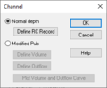
File:Channel Dialog.PNG WMS: Routing HEC-1 Cards | Channel Dialog Normal Depth Selected [[Category: HEC-1 Dialogs]](250 × 206 (4 KB)) - 22:53, 18 May 2020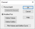
File:Channel Dialog-Modified Puls selected.PNG WMS Routing HEC-1 Cards Channel Dialog Modified Puls selected [[Category: HEC-1 Dialogs]](250 × 206 (4 KB)) - 22:56, 18 May 2020
File:GsshaStormDrainHydrographsFig2.png [[Category:GSSHA Dialogs]] [[Category:WMS Parameters]](934 × 470 (36 KB)) - 14:40, 5 June 2019
File:WMS - Cross Section Attributes dialog - Geo Ref tab.png The ''Geo Ref'' tab of the ''Cross Section Attributes'' dialog in WMS. [[Category:Hydraulic Dialogs]](351 × 317 (7 KB)) - 19:59, 4 January 2024
File:WMS - Cross Section Attributes dialog - Line Props tab.png The ''Line Props'' tab of the ''Cross Section Attributes'' dialog in WMS. [[Category:Hydraulic Dialogs]](352 × 316 (9 KB)) - 20:03, 4 January 2024
File:WMS - Cross Section Attributes dialog - Point Props tab.png The ''Point Props'' tab of the ''Cross Section Attributes'' dialog in WMS. [[Category:Hydraulic Dialogs]](352 × 315 (8 KB)) - 20:06, 4 January 2024
File:WMS - Cross Section Attributes dialog - Merge tab.png The ''Merge'' tab of the ''Cross Section Attributes'' dialog in WMS. [[Category:Hydraulic Dialogs]](348 × 316 (11 KB)) - 20:08, 4 January 2024
File:WMS - Cross Section Attributes dialog - Filter tab.png The ''Filter'' tab of the ''Cross Section Attributes'' dialog in WMS. [[Category:Hydraulic Dialogs]](350 × 316 (9 KB)) - 20:09, 4 January 2024
File:GsshaDepthVaryingRoughnessIndexMap.png [[Category:GSSHA Dialogs]] [[Category:WMS Job Control]](759 × 420 (23 KB)) - 14:12, 20 May 2019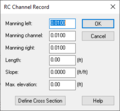
File:RC Channel Record Dialog.PNG WMS: HEC-1 Routing Cards | RC Channel Record Dialog [[Category: HEC-1 Dialogs]](271 × 251 (5 KB)) - 22:48, 18 May 2020
File:WMS GSSHA selection square example.png ...f the selection square in the GSSHA ''Pipe and Node Parameters'' dialog in WMS. [[Category:GSSHA Dialogs]](131 × 40 (880 bytes)) - 22:48, 17 May 2019
File:MWBM Wizard dialog - Read Existing Model.png The "Read Existing Model" page of the [[WMS:MWBM Wizard|''MWBM Wizard'' dialog]]. [[Category:MWBM Dialogs]](679 × 514 (42 KB)) - 15:40, 16 May 2019
File:MWBM Wizard dialog - Run Hydrologic Model.png The "Run Hydrologic Model" (Run GSSHA) page of the [[WMS:MWBM Wizard|''MWBM Wizard'' dialog]]. [[Category:MWBM Dialogs]](679 × 514 (36 KB)) - 20:04, 20 March 2019
File:Compute NSTPS Dialog (From Upstream).PNG WMS HEC-1 Compute NSTPS Dialog | From Upstream and Routed Hydrographs selected. [[Category:HEC-1 Dialogs]](370 × 367 (10 KB)) - 22:45, 14 May 2020
File:WMS-MODRATparametersOutlet.png [[Category:MODRAT Dialogs]] [[Category:WMS Parameters]](1,458 × 484 (38 KB)) - 19:40, 15 June 2023
File:WMS-MODRATparametersBasin.png [[Category:MODRAT Dialogs]] [[Category:WMS Parameters]](783 × 484 (26 KB)) - 19:38, 15 June 2023
File:TR20parameters.png [[Category:TR-20 Dialogs]] [[Category:WMS Quick Tour]](472 × 255 (7 KB)) - 17:22, 9 June 2023
File:WMS - Manage Cross Sections dialog.png [[Category:Hydraulic Dialogs]] The ''Manage Cross Sections'' dialog in WMS.(631 × 611 (21 KB)) - 20:13, 4 January 2024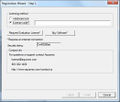
File:RegisterWizard1.jpg [[Category:Registration Dialogs]] [[Category:WMS General Information]](523 × 443 (50 KB)) - 16:11, 23 December 2015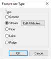
File:WMS Drainage Feature Arc Type.png [[Category:WMS Feature Objects]] [[Category:Drainage Dialogs]](200 × 232 (4 KB)) - 18:23, 22 June 2023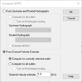
File:Compute NSTPS Dialog (From Channel).PNG WMS HEC-1 Compute NSTPS Dialog | From Channel Velocity Estimate selected. [[Category:HEC-1 Dialogs]](370 × 367 (10 KB)) - 14:11, 13 May 2021
File:TR20precipitation.jpg [[Category:TR-20 Dialogs]] [[Category:WMS Job Control]](391 × 297 (34 KB)) - 20:12, 28 July 2022
File:HEC1depthareastorm.png [[Category:HEC-1 Dialogs]] [[Category:WMS Job Control]](436 × 570 (11 KB)) - 16:24, 14 July 2020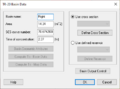
File:TR20basindata.png [[Category:TR-20 Dialogs]] [[Category:WMS Basins]](443 × 328 (9 KB)) - 17:19, 9 June 2023- [[Image:WMS XY SeriesEditor.jpg|thumb|none|left|600 px|Example of the ''XY Series Edito * [[WMS:DSS Files|DSS Files]]994 bytes (156 words) - 15:45, 28 September 2017
File:GsshaDepthVaryingRoughnessJobControl.png [[Category:GSSHA Dialogs]] [[Category:WMS Job Control]](755 × 360 (32 KB)) - 14:12, 20 May 2019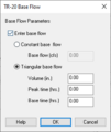
File:TR20baseflow.png [[Category:TR-20 Dialogs]] [[Category:WMS Job Control]](260 × 308 (6 KB)) - 17:59, 9 June 2023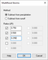
File:HEC1multifloodstorms.png [[Category:HEC-1 Dialogs]] [[Category:WMS Job Control]](260 × 326 (5 KB)) - 16:20, 14 July 2020
File:HEC-1 Diversion Data.PNG WMS HEC-1 Diversion Data Dialog. [[Category:HEC-1 Dialogs]](320 × 380 (6 KB)) - 22:41, 14 May 2020
File:HEC-1 Routing Data Dialog.PNG WMS: HEC-1 Routing Data dialog. [[Category: HEC-1 Dialogs]](764 × 338 (11 KB)) - 19:22, 20 May 2020
File:SmoothStreams.png [[Category:GSSHA Dialogs]] [[Category:WMS General Information]](503 × 593 (20 KB)) - 18:40, 22 May 2019
File:CrossSectionDatabase.png HEC-RAS Manage Cross Sections dialog in WMS [[Category:HEC-RAS Dialogs]](428 × 705 (29 KB)) - 17:39, 24 May 2018
File:HEC1 Basin Data.png [[Category:HEC-1 Dialogs]] [[Category:WMS Basins]](260 × 497 (7 KB)) - 22:41, 13 July 2020
File:Reservoir Routing Data dialog wms.PNG WMS: Routing HEC-1 Cards | Reservoir Routing Data dialog [[Category: HEC-1 Dialogs]](260 × 326 (6 KB)) - 22:59, 18 May 2020
File:HEC-1 Reservoir Routing Options.PNG WMS: Routing HEC-1 Cards | Reservoir Routing Options Dialog [[Category: HEC-1 Dialogs]](494 × 453 (13 KB)) - 22:50, 18 May 2020
File:WMSImage HMS Basin Options.png [[Category:HEC-HMS Dialogs]] [[Category:WMS Job Control]](592 × 436 (17 KB)) - 20:13, 15 June 2023
File:HMSMeteorologicalOptions1.png [[Category:HEC-HMS Dialogs]] [[Category:WMS Job Control]](592 × 436 (17 KB)) - 20:12, 15 June 2023
File:RationalMethodHydrograph.png [[Category:Rational Method Dialogs]] [[Category:WMS Plot]](260 × 300 (6 KB)) - 21:57, 8 June 2023- :# Set the horizontal and vertical projection using the [[Projection Dialogs#Display Projection Dialog|''Display Projection'']] dialog. <noinclude> [[Category:WMS Workflow Templates]] </noinclude>287 bytes (30 words) - 23:10, 14 November 2019
- ...rd guides the user through setting up the application on each system. Once WMS is installed, default settings can be adjusted and saved. ...stallation process, make sure the computer meets the [[System Requirements|WMS System Requirements]].2 KB (310 words) - 22:54, 27 January 2020
File:Dialog GSSHA Job Control.png [[Category:GSSHA Dialogs]] [[Category:WMS Job Control]](751 × 364 (19 KB)) - 21:34, 7 July 2020
File:WMSImage HMS Job Control.png [[Category:HEC-HMS Dialogs]] [[Category:WMS Job Control]](592 × 436 (18 KB)) - 20:08, 15 June 2023- ...neation and time of concentration calculations from feature objects (see [[WMS:Lag Time and Time of Concentration|Lag Time and Time of Concentration]]), m This section describes the mechanics of the WMS interface to TR-55 and is not a complete reference to the methodology, uses3 KB (391 words) - 16:08, 14 December 2017
- ...lues, Fm or Ybar) from the unit rainfall (Orange County IDF curves). The [[WMS:Rational_Method_Computing_Hydrographs#Rational_Hydrograph|Rational unit hyd # Exit all dialogs and select the hydrograph icon to view the runoff hydrograph2 KB (229 words) - 21:35, 21 November 2023
- ...tal elevation data can be formatted in the same way and then imported into WMS using the '''Open''' command in the ''File'' menu. This will bring up the ' [[Image:WMS Import ArcInfo Grid.jpg|thumb|none|left|350 px|''Importing ArcInfo Grid'' d2 KB (284 words) - 15:13, 5 January 2016
File:TR20joboutput.png [[Category:TR-20 Dialogs]] [[Category:WMS Job Control]](316 × 204 (4 KB)) - 18:01, 9 June 2023- ...s described in the information on [[WMS:River Tools|River Tools]] in the [[WMS:Map Module|Map module]]. :* [[WMS:Hydraulic Modeling|Hydraulic Modeling]]2 KB (308 words) - 16:24, 3 January 2019
File:TR20jobcontrol.png [[Category:TR-20 Dialogs]] [[Category:WMS Job Control]](451 × 354 (8 KB)) - 17:54, 9 June 2023- Breakline options option are controlled in the [[WMS:TIN Options|'''TIN Options''']] of the ''TINs'' menu. This dialog allows sp * [[WMS:Triangulation|Edge Swapping]]1 KB (207 words) - 21:54, 23 December 2019
- ...[[WMS:Introduction to ArcObjects#Enabling ArcObjects|enable ArcObjects]]. WMS uses the feature objects stored in each coverage to build the geodatabase. ...erence in the geodatabase is defined from the current coordinate system in WMS.2 KB (333 words) - 15:33, 31 January 2017
- #:[[File:WMS HEC RAS MP.png|150 px]] When WMS writes the SMPDBK input file, average roughness values are computed based o2 KB (266 words) - 20:30, 8 June 2023

File:WMS GSSHA Richards Parameters Dialog.png The [[WMS:GSSHA Job Control#Richard's Parameters Dialog|GSSHA ''Richard's Parameters' [[Category:GSSHA Dialogs]](220 × 266 (4 KB)) - 21:10, 24 October 2022- [[File:WMS Model Wrapper Dialog.png|thumb|right|550px|''Model Wrapper'' dialog]] The ''Model Wrapper'' dialog in WMS is used to display what is happening during a model run. The following info1 KB (173 words) - 19:24, 10 May 2019
- {{Version WMS 11.2}} ...MS 11.2! This page lists the exciting new features that have been added to WMS 11.2.3 KB (431 words) - 16:16, 30 May 2023

File:RationalMethodEditParameters.png [[Category:WMS Parameters]] [[Category:Rational Method Dialogs]](449 × 416 (19 KB)) - 21:33, 8 June 2023- WMS allows defining the watershed as a single basin or subdivide the watershed ...g the appropriate travel time. If desired, use a time computation arc to [[WMS:Lag Time and Time of Concentration|compute the travel time]].2 KB (262 words) - 16:40, 19 December 2017
- To use [[WMS:Display Options|Display Options]] in WMS, use the following steps: ...f the window, or click the [[WMS:Display Options|'''Display Options''']] [[WMS:Macros|'''macro''']].2 KB (266 words) - 18:56, 20 April 2023
- {{WMS Deprecated Feature}} * [[WMS:1D-HYD Centerline Coverage Type|1D-Hydraulic Centerline Coverage]]2 KB (251 words) - 14:52, 30 October 2018
- ...t data to run one of the supported models can be defined using a series of dialogs. This module is used for interfacing to hydrologic models and for the const ...ed with all [http://www.aquaveo.com/software/wms-pricing paid editions] of WMS. [[Category:Link to Store]] This module is the primary module available for2 KB (270 words) - 23:13, 13 May 2021
- The drainage module has a number of tools to edit feature objects. The dialogs can be reached by double-clicking on feature object or by selecting the fea [[Image:WMS Drainage Feature Arc Type.png|thumb|175 px|Drainage ''Feature Arc Type'' di3 KB (432 words) - 21:22, 12 December 2023
- ...read the solution back into WMS by opening the HMS DSS solution file from WMS. ...e the DSS file to view is located. Open the DSS file and a [[WMS:DSS Files-WMS Interface|dialog]] like the following will show up.2 KB (308 words) - 18:20, 25 March 2020
- ...lready exist. In order to take advantage of this type data when available, WMS allows hydrologic models to be built directly from three different features ...would have to be determined by some other means and defined in appropriate dialogs prior to running one of the supported hydrologic models).1 KB (223 words) - 16:14, 24 February 2016
- ...ow is calculated. Once all of the items listed in this window are entered, WMS performs the calculation for peak discharge and displays the result in the ...55 does not require that basin names are unique, other models supported by WMS do.2 KB (295 words) - 16:34, 19 December 2017
- ...tc. Also enter variable names corresponding to the basin data computed by WMS, or enter variables that to define. The variable definition is displayed an * [[WMS:Travel Times from Basin Data|Travel Times from Basin Data]]2 KB (300 words) - 18:41, 5 December 2016
- * [[WMS:DSS Files|DSS Files]] * [[WMS:XY Series Files|XY Series Files]]1 KB (170 words) - 15:43, 24 February 2016
- Like the other models supported by WMS, the Rational Method can be defined for a watershed/catchment developed fro **[[WMS:Rational Method Rainfall Intensity|Compute I – IDF Curves]]2 KB (330 words) - 21:33, 8 June 2023
- ...emperatures''', and '''Define precipitation concentrations''' buttons open dialogs to add precipitation and its temperature and constituent concentrations to ...ad concentrations''' buttons become active. Selecting these buttons opens dialogs that specify the elevations, temperatures, and concentrations of the extern4 KB (578 words) - 15:03, 6 October 2017
- * '''F<sub>m</sub>''' – Maximum area [[WMS:OC Losses|loss rate]] * [[WMS:OC Losses|Losses]]2 KB (259 words) - 21:34, 21 November 2023
- ...on of MODRAT input data. Furthermore, MODRAT can be launched directly from WMS through menu options. These menus can be found in the Hydrologic Modeling m * [[WMS:MODRAT#Saving_and_Reading_MODRAT_Files|'''Save MODRAT File''']] – Sa3 KB (434 words) - 15:43, 12 October 2017
- [[Image:WMS Display Options 2D Grid.jpg|thumb|500 px|''Display Options'' dialog showing *The ''Nodes'' item is used to display grid nodes. Since all grids in WMS 7.0 are cell-centered, a dot is displayed at the cell centers.3 KB (549 words) - 14:56, 6 October 2017
- ...tionality in WMS that is available in ArcView®, but this is only providing WMS is running on a computer that has a current license of ArcView®. Without a .... If a license is not found then the ArcView® functions remain dimmed, but WMS is able to do many of the same things, the primary limitation being that on2 KB (402 words) - 15:34, 2 February 2016
- ...he first six plot types are related to the two-dimensional runoff model, [[WMS:GSSHA|GSSHA]], where a series of results for the finite difference grid, an [[File:WMS PlotWizard2.jpg|thumb|none|400 px|Step 2 of the ''Plot Wizard'' using the M2 KB (305 words) - 15:07, 10 January 2017
- The ''XY Series Editor'' is used in GMS, SMS, and WMS. It was designed to be general in nature so that it could be used anywhere * [[WMS:WMS|WMS main page]]3 KB (533 words) - 19:57, 24 January 2023
- * [[WMS:1D-HYD Cross Section Coverage Type|Cross Section Coverage]] * [[WMS:Area Property Coverage|Area Property Coverage]]2 KB (271 words) - 18:47, 4 January 2024
- ...nting to start over with HSPF input or wanting to use another model within WMS. ...ntains input for the simulation, these files should be merged for use with WMS. The filename fields complete the data necessary for the FILES block of HSP2 KB (351 words) - 15:29, 26 August 2016
- ...lso available directly from within many of the hydrologic model parameter dialogs where time of concentration, lag time, or routing travel time is needed. ...re time computation types and methods can be selected. This dialog has a [[WMS:Customizing Equations|'''Modify Equation''']]and a '''User Defined''' optio3 KB (489 words) - 16:43, 2 October 2017
- The control option data entered in WMS is exported to the HMS project and used to set the appropriate HMS paramete The basin option data entered in WMS is exported to the HMS project and used to set the appropriate HMS paramete2 KB (359 words) - 16:24, 11 October 2017
- #redirect [[Projection Dialogs]] ...each projection and the information in these dialogs can be found in the [[WMS:Projections]] article.5 KB (700 words) - 21:34, 24 January 2019
- ...urve dialog.png|right|thumb|The ''Detention Basin Rating Curve'' dialog in WMS.]] [[Category:GSSHA Dialogs|Detention]]1 KB (162 words) - 20:23, 24 April 2019
- [[Image:WMS Coverage Overlay.jpg|thumb|275 px|''Coverage Overlay'' dialog]] ...ing the basins. These values are often needed for computations using the [[WMS:NSS|National Streamflow Statistics]] (NSS) program of regional regression e3 KB (451 words) - 15:29, 29 September 2017
- ...e to enable importing, exporting, viewing, and editing DSS files inside of WMS. ...d edit a DSS file. This dialog comes up when reading a DSS file from the [[WMS:XY Series Editor|XY Series Editor]] or from the '''Open''' command in the '3 KB (556 words) - 18:56, 29 June 2018
- ...ative WMS Files]] for a list. For files that are not included in the list, WMS provides the ''File Import Wizard''. ...iated by pasting data from a text file or spreadsheet into WMS using the [[WMS:Edit Menu#Paste|Paste]] command from the ''Edit'' menu.4 KB (689 words) - 20:51, 4 May 2020
- ...w WMS automatically rounds elevations values when a DEM is imported. See [[WMS:Smoothing DEMs|Smoothing DEMs]] for more information. * '''Trim''' – See [[WMS:Editing DEMs|Editing DEMs]] for more information on the ''Trim'' commands.3 KB (440 words) - 22:08, 16 December 2019
- ...n an inflow hydrograph can be analyzed and an output hydrograph created in WMS using the ''Detention Basin'' calculator. This same calculator is also used # A [[WMS:Hydrographs|hydrograph]].3 KB (388 words) - 16:09, 9 February 2017
- *[[WMS:Basin HEC-1 Cards|Basin HEC-1 Cards]] *[[WMS:Routing HEC-1 Cards|Routing HEC-1 Cards]]2 KB (326 words) - 22:11, 13 July 2020
- ...in and then choosing the '''Unit Hydrograph Method...''' button from the [[WMS:Orange County Unit Hydrograph|''Edit Orange County Unit Hydrograph Paramete Clicking on '''OK''' will write the unit hydrograph data to the [[WMS:Basin HEC-1 Cards#Derived Unit Hydrograph (UI)|UI]] card for analysis using2 KB (281 words) - 16:18, 7 December 2017
- [[Image:WMS Exporting Plot Data.jpg|thumb|375 px|''Exporting'' dialog]] * Clicking the '''Export...''' button in the [[WMS:Customization Dialog|''Customization...'' dialog]].2 KB (354 words) - 18:35, 22 May 2019
- ...water.usgs.gov/software/HSPF/]). The ''Assign External Sources'' dialog in WMS has been developed to allow setting up the required external sources for an ...s''' is present in each of the [[WMS:HSPF Modules|HSPF module dialogs]] in WMS. Upon clicking this button, the ''Assign External Sources'' dialog box is a2 KB (351 words) - 17:37, 18 February 2016
- ...[[WMS:HEC-HMS Gages|''User Gage Weighting'']] option is selected in the [[WMS:HEC-HMS Defining the Meteorological Model|''HMS Meteorological Model'' dial ...s the points in an XMRG file to incremental distribution rain gages in a [[WMS:Rain_Gage|rain gage coverage]]. These gages can then be tied to a basin in2 KB (374 words) - 21:25, 12 December 2023
- ...sections, a prompt will ask for the name of a cross section database file. WMS stores all of the cross section information in a text database file. The cr * [[WMS:Editing Cross Sections|Editing Cross Sections]]2 KB (292 words) - 16:57, 13 June 2018
- ...of weirs, outlets, and standpipes along with their individual parameters. WMS will then compute an elevation discharge relationship with an appropriate e ...levation-discharge computations for this crossing are then assigned to the WMS Elevation Discharge relationship. The hydrograph is routed based on the HY2 KB (274 words) - 14:50, 4 October 2016
- * [[WMS:OC Rational Sub-area Data|Sub-area Data]] * [[WMS:OC Rational Reach Routing|Reach Routing]]2 KB (263 words) - 15:58, 14 December 2023
- ...fall event, and are primarily a function of the geometry of the watershed. WMS provides two powerful methods of computing travel times for lag time and ti ...ost of these equations are a function of the [[WMS: Variables Computed by WMS|geometric parameters computed from digital terrain models]].4 KB (579 words) - 16:07, 7 December 2016
- [[Image:WMS DEM Trim by Elevation.png|thumb|225 px|''DEM Trim by Elevation'' dialog]] [[Image:WMS DEM TrimArea.png]] [[Image:WMS DEM trimmed.png]]3 KB (417 words) - 16:59, 9 August 2022
- ...ction 4.6.4.2 of the HSPF manual[http://water.usgs.gov/software/HSPF/]. In WMS, a list of mass links may be created for each segment type: PERLND, IMPLND, * [[WMS:HSPF|Overview of HSPF]]2 KB (295 words) - 21:02, 13 December 2023
- ...nded to the nearest hydrograph value for the standard version of TR-55. In WMS hydrographs are determined by linear interpolation between two hydrographs ...he peak flows from these two different methods will usually be different. WMS uses the method described in Exhibit 5 in the TR-55 manual to compute a hyd3 KB (523 words) - 14:21, 19 October 2017
- * [[WMS:TR-20|TR-20 Overview]] * [[WMS:TR-20 Job Control Parameters|Entering Job Control Parameters]]3 KB (441 words) - 20:58, 13 December 2023
- #Load the *.tif, or *.jpg image into WMS and [[Registering an Image|register]] according to the latitude and longitu * [[WMS:NSS|NSS Model]]2 KB (317 words) - 15:10, 26 October 2016
- While future versions of WMS may be able to process some commands directly from the GIS data layers, cur ...and make sure that it has an attribute set of Soil Type. After making sure WMS will be mapping to the correct coverage, select the polygons which overlay3 KB (528 words) - 17:28, 2 October 2017
- ...d with each feature in the layer (as rows). Tables cannot be edited within WMS; this is only a way to explore and discover the nature of the database asso ...IS data layer on the hard drive of the computer, it only exists within the WMS application.2 KB (430 words) - 22:09, 18 December 2019
- * [[WMS:Contour Options|WMS Contour Options]] [[Category:SMS Display Dialogs]]4 KB (551 words) - 18:09, 16 May 2023
- * [[WMS:Contour Options|WMS Contour Options]] [[Category:SMS Display Dialogs]]4 KB (553 words) - 18:35, 5 January 2024
- * {{done}} [[WMS:GSSHA Calibration|Calibration]] ...room, needs better header level formatting, tutorial link at bottom is for WMS v8.19 KB (1,379 words) - 22:53, 22 July 2020
- ...ng, it's necessary to link the appropriate soil type variables to each ID. WMS allows completing this in one of two ways. First of all, with the soil type Parameter values for soil type IDs are defined by selecting the ID in the WMS soil type ID text window and the parameter from the selected soil type prop3 KB (500 words) - 21:56, 18 December 2019
- A Land Use coverage in WMS has a different purpose depending on the model and/or model parameters assi ...necessary to link the appropriate land use variables to each land use ID. WMS allows completing this in one of two ways. First of all, with the land use3 KB (520 words) - 15:46, 10 January 2024
- The toolbar for the WMS [[WMS:GIS Module|GIS module]] has a variety of tools useful for selecting objects ...ributes of the selected feature in the top most layer (as displayed in the WMS Project Explorer) are displayed, but the ''Layers'' drop down combo can be3 KB (529 words) - 14:22, 1 May 2018
- ...on Coverage article and related cross section articles. see [[User:Jmonson/WMS:1D-HYD_Cross_Section_Coverage_Type]]--> * [[User:Jcreer/WMS 99.99 TR-20 Changes]]13 KB (1,899 words) - 00:00, 28 February 2024
- ...hannel routing. Structures are defined in the same way as structures for [[WMS:TR-20 Reservoir Data|reservoir routing]]. ...is diverted. For this method, define what this constant outflow is. Also [[WMS:TR-20 Routing Data#Defined Cross Sections|define a cross section]] and the2 KB (341 words) - 22:22, 27 April 2020
- * [[WMS:SMPDBK|Simplified Dam-Break Analysis]] * [[WMS:Interpolating Hydraulic Model Results|Interpolate Results]]2 KB (254 words) - 23:50, 12 December 2017
- ...possible to enter surveyed cross sections, however in order to use them in WMS for floodplain delineation, or modeling of any kind they must be georeferen *Line Prop Types – By default, WMS uses only a Material ID, but other properties could be defined for general3 KB (415 words) - 22:38, 4 May 2020
- ...asin and then choosing the '''Effective Precipitation''' button from the [[WMS:Orange County Unit Hydrograph|''Edit Orange County Unit Hydrograph Paramete ...ick on the '''Compute Mountainous''' button if a DEM or TIN exists to have WMS calculate the amount of mountainous terrain in the sub-area.3 KB (380 words) - 15:58, 13 December 2017
- ...already defined. To set up a groundwater model in [[WMS:GSSHA|GSSHA]] with WMS, do the following: :#Interpolate the aquifer bottom data set to the 2D grid to create a new [[WMS:GSSHA_Maps#Grid_Continuous_Maps|continuous map]] for the aquifer bottom.4 KB (526 words) - 18:55, 5 May 2023
- # The time of concentration can be computed outside of WMS and entered into the appropriate edit field. # The [[WMS:Travel Times from Basin Data|Compute Tc – Basin Data]] button can be3 KB (514 words) - 14:06, 19 October 2017
- ...r each basin, define one or more total storm gages and one recording gage. WMS has the capability to automatically determine gage weights for each sub-bas ..._Systems|coordinate system]]. The RADAR grids are read by selecting the [[WMS:HEC-HMS Convert Grids|'''Radar Data→Rain Gages''']] button and definin3 KB (470 words) - 16:23, 11 October 2017
- Most of the data types ([[WMS:Modules|modules]]) in WMS have a set of display options that can be modified using the '''Display Opt ...r, or when selecting a color from within the ''Line or Symbol Attributes'' dialogs.4 KB (681 words) - 15:35, 28 September 2017
- [[WMS:Display Menu|Display Menu]] [[Category:WMS 2D Grid|G]]2 KB (308 words) - 20:23, 12 December 2023
- * [[WMS:OC Rational Sub-area Data|Sub-area Data]] * [[WMS:Orange_County_Rational_Method#Reports|Reports]]2 KB (254 words) - 15:24, 16 October 2017
- ...must be numbered and lettered properly, from most upstream to downstream. WMS will automatically number and letter the watershed components once a topolo ...orresponding to each lateral as prompted to do so in the dialog. Note that WMS will automatically skip numbers/letters at certain confluences to allow for3 KB (521 words) - 16:01, 12 October 2017
- [[File:WMS SubsetDefinition.png|thumb|300 px|The ''Subset Definition'' dialog]] In the [[WMS:Inverse Distance Weighted Interpolation|''IDW Interpolation Options'']] dia2 KB (389 words) - 15:48, 30 November 2016
- ...r storage capacity curves, but the primary use of ''Plot Windows'' is to [[WMS:Hydrographs|display the hydrographs]] that result from hydrologic modeling ...and ''Save Settings'' menus will not perform any action within WMS. The [[WMS:Customization Dialog|'''Display Options''']] command will allow control of4 KB (649 words) - 16:10, 1 May 2023
- {{WMS Deprecated Feature}} ...play in the WMS window according to this projection and any data mapped to WMS coverages will be mapped into the coordinate system specified by the ''Map4 KB (508 words) - 18:56, 17 December 2019
- DEM files can be converted by WMS into TINs or feature objects. ...equired. More efficient ways of converting DEMs to a TIN include using a [[WMS:Creating TINs|bounding polygon]] and interior breakline arcs (i.e. streams3 KB (450 words) - 22:42, 17 December 2019
- * [[WMS:GIS Tools|GIS Tool Palette]] * [[WMS:Mapping to Feature Objects|Mapping GIS Features to Feature Objects]]2 KB (393 words) - 17:31, 2 October 2017
- [[File:WMS GSSHA Model Linkage dialog.png|thumb|right|380 px|''GSSHA Model Linkage'' d ...sible by clicking the '''Model Linkage...''' button at the bottom of the [[WMS:GSSHA Job Control|''GSSHA Job Control'' dialog]]. It allows linking the cur3 KB (561 words) - 21:29, 15 May 2019
- ...accessed by selecting a DEM point with the '''Select DEM Points''' [[File:WMS SelectDEMpointsTool.svg|13 px]] tool and choosing the '''Point Attributes'' ...ery tedious and should only be used for small local changes. If desired, [[WMS:Editing DEM Elevations|edit elevations]] using feature arcs if wanting to m4 KB (605 words) - 22:10, 17 December 2019
- [[Image:WMS Tin Options.png|thumb|400 px|''TIN Options'' dialog]] ...ation of vertices should be done once digitizing vertices are completed. [[WMS:Creating TINs|See creating a TIN from a scanned image]] for more informatio4 KB (624 words) - 19:15, 13 May 2020
- ...he rainfall mass curves to be used by MODRAT. This file will be created by WMS—name it anything appropriate. ...th the ''Detention Basin Calculator'' in WMS, this file will be created by WMS – name it anything appropriate. If having manually created this file in t4 KB (592 words) - 15:59, 12 October 2017
- ...' window provides both information and opportunities to edit properties of WMS entities. ...For example, if selecting a feature polygon representing a basin boundary, WMS will also select the associated basin in the hydrologic tree.4 KB (534 words) - 17:14, 17 January 2024
- ...page is to explain how to obtain a registration code and enable WMS. When WMS is first launched, the following window appears: To get started using WMS, the software must be registered. Register WMS by choosing the '''Register...''' button. The following window will appear6 KB (1,003 words) - 22:24, 24 June 2020
- ...page is to explain how to obtain a registration code and enable WMS. When WMS is first launched, the following window appears: To get started using WMS, the software must be registered. Register WMS by choosing the '''Register...''' button. The following window will appear6 KB (1,029 words) - 15:41, 4 February 2015
- ...ious), and DPA zones are all available from the LACDPW. Once the map is in WMS, functions have been created which will overlay the parameter map on the wa ...ype data is present in WMS, compute and assign soil numbers using the '''[[WMS:Importing Shapefiles|Map Attributes]]''' command from the ''MODRAT'' menu.5 KB (871 words) - 19:52, 4 January 2024
- ...point or manually changing the flow direction can also be edited in the [[WMS:DEM Point Attributes|''DEM Point Attributes'']] dialog. * [[WMS:DEM Point Attributes|Point Attributes]]3 KB (470 words) - 17:10, 2 October 2023
- WMS, beginning in version 9.1, uses ''Hydraulic Toolbox'' to perform the channe ...across a specified arc, as long as the user has elevation data loaded into WMS then turn on cross sections. The image showing channel geometry becomes upd4 KB (587 words) - 21:57, 4 May 2020
- {{TOC right}}The "GSSHA Storm Drain" coverage in WMS is used to hold feature arcs, nodes, and polygons related to subsurface dra ...in a "GSSHA Storm Drain" coverage. This makes it so pipes drawn inside of WMS do not impact stream elevations in the "GSSHA" coverage.4 KB (566 words) - 21:47, 21 May 2019
- =The Path of Data from WMS to HY8 in the HY8 Modeling Wizard= The HY8 Modeling Wizard in WMS gathers data to setup an HY8 model. Some data can be changed at multiple l5 KB (747 words) - 15:01, 20 October 2017
- {{WMS Deprecated Feature}} [[Image:WMS FHWA Storm Drain JC.jpg|thumb|400 px|''FHWA Storm Drain Job Control'' dialo4 KB (575 words) - 15:13, 13 June 2019
- [[File:WMS DynamicToolsQuick.png|thumb|right|The toolbar for the Terrain Data module.] The toolbar for the WMS [[WMS:Terrain Data Module|Terrain Data module]] has a variety of tools useful for4 KB (704 words) - 14:16, 1 May 2018
- ...in GSSHA requires turning on the ''Contaminant transport'' option in the [[WMS:GSSHA Job Control|''Job Control'' dialog]]. ...e one to be used with the contaminant. This can also be specified in the [[WMS:GSSHA Mapping Tables|''GSSHA Map Table Editor'' dialog]].3 KB (497 words) - 17:10, 15 April 2019
- ...IS data as Feature Objects, and tools for using them are included in the [[WMS:Map Module|Map Module]]. Feature object data can be used by itself to creat ...ese data are often already developed and stored in a GIS, importing from [[WMS:Importing Shapefiles|ARC/INFO® and ArcView®]], or DXF files is easily don4 KB (742 words) - 16:00, 26 October 2017
- ...h''' – One or more input hydrographs can be defined for a reservoir. WMS will combine any input hydrographs with other input hydrographs to the rese * [[WMS:TR-20|TR-20 Overview]]2 KB (347 words) - 20:58, 13 December 2023
- ...ould have been defined using WMS. If the simulation was not defined using WMS, define branch and segment coverages representing the branches and segments ...created when selecting the '''Map→CE-QUAL-W2 Grids''' menu command. WMS reads the solution values from the CE-QUAL-W2 snapshot files and the soluti4 KB (709 words) - 21:01, 13 December 2023
- ...ndaries''' command. The drainage basin boundaries option in the Drainage [[WMS:Display Options|''Display Options'']] dialog is automatically set when defi ...boundaries can be split using the '''Refine Boundaries''' command in the [[WMS:Drainage_Module_Menus#Drainage_TIN_Menu|''TIN'']] menu for the Drainage mod6 KB (943 words) - 22:41, 30 December 2019
- A flood extent coverage is created from a [[WMS:Delineate Floodplain|flood delineation dataset]] and contains polygons show ...y showing the extent of a floodplain. These coverages can be exported from WMS for reporting or use with Geographic Information Systems (GIS) to perform o5 KB (709 words) - 15:48, 10 January 2024
- ...string crosses triangle edges, a prompt will ask if wanting to insert a [[WMS:TIN Breaklines|breakline]]. The breakline is inserted by creating new poin The '''Delete Stream Segments''' command (in the [[WMS:Drainage_Module_Menus#Drainage_TIN_Menu|''TIN'']] menu for the Drainage mod4 KB (662 words) - 21:56, 30 December 2019
- ...been loaded into WMS and can be used when running the WinTR-20 model from WMS. * [[WMS:TR-20|TR-20 Analysis]]4 KB (615 words) - 20:59, 13 December 2023
- ...h the basin. The name can not be more than six characters long. By default WMS uses the basin ID number followed by a "B" for the name, but a descriptive ...ndash; When a [[WMS:TIN Guidelines|TIN]], [[WMS:DEM Guidelines|DEM]], or [[WMS:Feature Object Guidelines|map-based]] model is present, basin areas and slo5 KB (784 words) - 17:18, 9 June 2023
- ...analysis is similar to the [[WMS:HEC-1 Parameters|HEC-1 interface]] within WMS. Some of the processes specific to Orange County are described below: * '''Open HEC-1 File''' – [[WMS:HEC-1#Reading_Existing_Files|Reads in]] existing HEC-1 files.6 KB (903 words) - 15:59, 14 December 2023
- ...is superior in all cases, several interpolation techniques are provided in WMS. [[Image:WMS 2D Interpolation Options.jpg|thumb|225 px|''2D Interpolation Options'' dial4 KB (631 words) - 21:26, 4 May 2020
- The toolbar for the WMS [[WMS:Map Module|Map module]] has a variety of tools useful for editing and creat {{WMS Select Feature Point/Node}}5 KB (846 words) - 20:45, 17 December 2019
- ...nstream. Currently, this coverage only supports links and nodes for the [[WMS:SWMM|SWMM model]]. ...done this, define model specific data on the hydraulic schematic in the [[WMS:Project Explorer Contents for River Module|river module]].5 KB (866 words) - 16:25, 3 January 2019
- Changing the preferences for the WMS interface can be done through the ''Preferences'' dialog. This dialog can b :[[File:WMS ProjectExplorer1.png]]6 KB (909 words) - 18:25, 8 June 2021
- ...ndividual basin segments as well as the area of the basin as calculated by WMS if a terrain model was used to calculate basin data. A radio group is locat * [[WMS:HSPF External Targets|WMS:HSPF External Targets]]3 KB (556 words) - 21:25, 12 December 2023
- [[Image:WMS DEM Smoothing Options.png|thumb|225 px|''DEM Smoothing Options'' dialog]] ...read in the DEM can be smoothed using the '''Smooth''' command from the [[WMS:DEM Menu|''DEM'']] menu.3 KB (495 words) - 16:46, 7 January 2020
- WMS includes an interface to the Orange County Rational Method which can be use All of the computations for peak flows and routing are done within WMS.5 KB (711 words) - 21:30, 21 November 2023
- ...in HMS. The results from these models can then be read into and viewed in WMS. WMS provides GIS, watershed modeling, and HMS parameter computation capabilitie6 KB (961 words) - 19:05, 5 May 2020
- ...cting the '''Dataset Calculator''' in the ''Edit'' menu. It is accessed in WMS by selecting the '''Data Calculator''' command from the ''Edit'' menu. The * [[WMS:Datasets|Datasets (WMS)]]5 KB (846 words) - 22:50, 22 February 2023
- {{WMS Deprecated Feature}} [[Category:Projection Dialogs]]1 KB (222 words) - 15:19, 19 June 2019
- * [[WMS:Orange County Rational Method|Orange County Rational Method]] [[Category:OC Rational Dialogs|T]]1 KB (166 words) - 15:20, 26 June 2018
- ...SHA Storm Drain)|''Properties'' dialog]]. This is only accessible when a [[WMS:GSSHA Storm Drain#GSSHA Storm Drain Coverage|GSSHA storm drain coverage]] i ...commended to add more than one pipe (two nodes) between superjunctions. In WMS, superlinks are represented as arcs and superjunctions are represented by t7 KB (1,189 words) - 23:12, 17 May 2019
- This menu is available when a GSSHA coverage is the active coverage, or if WMS is switched to the '''Map''' [[File:Map Module Icon.svg|16px]] module. : Opens the [[WMS:Smooth GSSHA Streams#Stream Smoothing|''Smooth GSSHA Streams'' dialog]].6 KB (964 words) - 17:57, 21 May 2021
- [[File:WMS DrawingToolsQuick.png|thumb|right|The Annotation toolbar.]] ; Select Drawing Objects : The '''Select Drawing Objects''' [[Image:WMS SelectDrawingObjectsTool.svg|15 px]] tool is used to select the previously8 KB (1,366 words) - 21:18, 12 December 2023
- ...n or lag time. If the equation is a function of a variable not computed by WMS then enter the value in this dialog before a travel time can be computed. T # [[WMS:Assigning an Equation|Select an equation]] (or create a new one).6 KB (845 words) - 20:27, 13 May 2020
- ...essed by turning on ''Soil erosion'' in the other options section of the [[WMS:GSSHA Job Control|''GSSHA Job Control Parameters'' dialog]] and clicking th ...map]] can be created that incorporates the sediment types as needed. The [[WMS:GSSHA Mapping Tables|''GSSHA Map Table Editor'' dialog]] can then be used t4 KB (582 words) - 19:39, 17 May 2019
- ...anizing all the datasets associated with the several models and modules in WMS. In the 2D Grid module, the Project Explorer serves to store and modify the ...rves as a manager for all of the gridded datasets that have been read into WMS. When other modules are active the Project Explorer references TINs, DEMs,6 KB (941 words) - 23:19, 16 May 2019
- *[[WMS:1D-HYD Centerline Coverage Type|WMS 1D-HYD Centerline Coverage Type]] [[Category:SMS Map Dialogs|1D hyd]]2 KB (313 words) - 22:48, 15 August 2022
- * [[WMS:OC Rational Sub-area Data|Sub-area Data]] [[Category:OC Rational Dialogs|I]]1 KB (181 words) - 15:33, 6 December 2016
- ...additional information on [[WMS:Importing USGS DEMs|importing DEMs]] and [[WMS:Importing Shapefiles|ArcView® Shapefiles]]. ...types listed below, several other types of data can be imported via the [[WMS:File Import Wizard|''File Import]] Wizard''.6 KB (1,032 words) - 15:42, 24 February 2016
- #Assign a cross section from a database by double-clicking on an arc in a [[WMS:1D-HYD Cross Section Coverage Type|1D Hydraulic Cross Section]] coverage. A ...cross section database for editing (or create a new database) using the [[WMS:Managing Cross Sections|'''Manage Cross Sections''']] command.5 KB (849 words) - 22:48, 4 May 2020
- ...or by selecting the '''Delete''' command from the ''Edit'' menu. If the [[WMS:Edit Menu|''Confirm deletions'']] option is active, a prompt will ask to co ...g ''Vertices'' | '''Delete Duplicates''' from the ''TIN'' menu. Otherwise, WMS may abort when the vertices are triangulated. The tolerance for duplicate v5 KB (824 words) - 20:57, 3 January 2020
- WMS automatically assigns the correct type (generic, link break, or junction) t ...pen a separate dialog. The options for feature arcs are described in the [[WMS:GSSHA Feature Arcs|GSSHA Feature Arcs]] article.6 KB (1,029 words) - 22:06, 7 July 2020
- The '''Get Data''' [[File:WMS GetDataToolIcon.svg|16 px]] tool is used to get data from the web or from a ...for a community of users it is convenient to catalog the necessary files. WMS can read a database catalog and then automatically open any files that fit5 KB (828 words) - 15:35, 23 January 2018
- ...ed with all [http://www.aquaveo.com/software/wms-pricing paid editions] of WMS (10.1 comes with HEC-RAS 5.0.1). [[Category:Link to Store]] ...ormation on the tools and processes to set up a river schematic, see the [[WMS:Stochastic Modeling#Step 2. Develop a working model in HEC-RAS|1D River Hyd7 KB (1,097 words) - 20:32, 8 June 2023
- * [[WMS:TR-20|TR-20 Overview]] * [[WMS:TR-20 Edit Parameters|Editing TR-20 Parameters]]2 KB (311 words) - 23:53, 12 December 2017
- ...red as part of the attributes of a feature point in the "GSSHA" and the "[[WMS:GSSHA Storm Drain|GSSHA Storm Drain]]" coverage types. Observations can be [[File:WMS GSSHA Observations dialog.png|thumb|right|600 px|''GSSHA Observations'' dia5 KB (750 words) - 00:50, 17 May 2019
- '''''See [[WMS:TR-55 Edit Parameters|TR-55 Edit Parameters]].''''' <!--Addition to the TR- See [[WMS:TR-55 Basin Data|TR-55 Basin Data]].6 KB (905 words) - 23:42, 12 December 2017
- * [[WMS:Contour Options|Contour Options]] * [[WMS:Contour Options#Contour Labels|Contour Labels]]4 KB (584 words) - 15:16, 4 May 2016
- [[File:WMS Film Loop.png|thumb|400 px|Example of the ''Film Loop Setup'' wizard.]] One of the most powerful 2D visualization tools in WMS is animation. An animation sequence can be generated for a grid with a tran4 KB (674 words) - 20:25, 16 June 2022
- WMS uses a third party set of DLLs to read CAD files. This is done so that WMS can stay current with evolving changes in DXF and other file formats. Previ WMS can use CAD files as base map (background) information to the project, and7 KB (1,118 words) - 22:21, 2 April 2021
- [[File:WMS GSSHA Solution Analysis dialog.png|thumb|450 px|''GSSHA Solution Analysis'' ...t dot button.png|16px]] button in the ''Solution Results'' column in the [[WMS:GSSHA Feature Nodes#Properties Dialog|GSSHA feature points/nodes ''Properti4 KB (533 words) - 20:48, 21 May 2019
- ; TIN Options : Brings up the ''TIN Options'' dialog. See the article [[WMS:TIN Options|TIN Options]] for more information. ::[[Image:WMS Merge TINs.png|thumb|none|left|350 px|WMS ''Merge TINs'' dialog]]7 KB (1,157 words) - 19:57, 13 May 2020
- ...n be defined in WMS using the commands in the ''TR-20'' menu and resulting dialogs. ...ed with all [http://www.aquaveo.com/software/wms-pricing paid editions] of WMS. [[Category:Link to Store]]9 KB (1,402 words) - 17:25, 29 July 2022
- ...n be defined in WMS using the commands in the ''TR-20'' menu and resulting dialogs. ...in the interface. These rainfall distributions can be accessed from the [[WMS:TR-20_Job_Control_Parameters#Precipitation|TR-20 precipitation dialog]] whe12 KB (1,886 words) - 17:24, 29 July 2022
- The ''Registration Wizard'' dialogs for all of Aquaveo's products are very similar, so the following informatio *[[WMS:Registering WMS|Registering WMS]]3 KB (444 words) - 20:16, 12 September 2019
- ...then to run HSPF. The input parameters are linked to all the tools within WMS including automated basin delineation and parameter definition using a grap ...ed with all [http://www.aquaveo.com/software/wms-pricing paid editions] of WMS. [[Category:Link to Store]]8 KB (1,258 words) - 15:27, 6 February 2017
- ...for hydrologic analysis, HEC-RAS for 1D hydraulic river modeling, and the WMS floodplain delineation tools. :[[File:WMS StochasticModeling.jpg|thumb|none|left|300 px|]]11 KB (1,707 words) - 20:24, 12 December 2023
- Output for several of the hydrologic models includes a hydrograph. WMS allows hydrographs to be displayed and compared. Multiple hydrographs can b The hydrograph should be selected prior to bringing up the [[WMS:Detention Basin Calculator|detention basin calculator]].8 KB (1,359 words) - 16:00, 31 January 2017
- ...nique name to each diversion in a given model because this name is used by WMS and by HEC-1 to identify the diversion. '''Define DI''' – Select to bring up the [[WMS:XY Series Editor|''XY Series Editor'' dialog]] and define inflow.5 KB (781 words) - 22:44, 13 July 2020
- *''Soil texture'' – A drop-down list of [[WMS:List of SSURGO soil textures|all available SSURGO soil textures]] in the SS Because there are often missing fields in the data, this allows WMS to provide a default value to be assigned to missing fields to avoid blanks4 KB (572 words) - 21:11, 1 May 2019
- ...also be accessed by toggling on the display of Job Control cards in the [[WMS:HEC-1 Parameters|''Edit HEC-1 Parameters'']] dialog and then clicking on a .... This diagram should appear similar to the tree representation created by WMS.7 KB (1,119 words) - 17:07, 23 May 2022
- ...bration|automated]] and manual calibration. There is a [[WMS:WMS_Tutorials|WMS tutorial]] that describes how to set up a basic calibration model. ...'' column of the ''Feature Point/Node Properties'' dialog to display the [[WMS:GSSHA Solution Analysis|''Solution Analysis'']] dialog, which allows both v6 KB (921 words) - 17:58, 12 April 2019
- ...eling System]], the [[GMS:GMS|Groundwater Modeling System]], and the [[WMS:WMS|Watershed Modeling System]] (collectively called "XMS"), as well as [[AHGW: Most dialogs in SMS, GMS, and WMS contain a '''Help''' button at the bottom of the dialog window. Clicking th4 KB (661 words) - 18:19, 17 September 2019
- In WMS, man-made embankments are represented as embankment arcs. These embankment ...evations can be generated by entering the parameters for a vertical curve. WMS will then take the given parameters and compute the correct elevation value5 KB (725 words) - 19:38, 22 May 2019
- ...1995) have developed methods to extract watershed geomorphology from DEMs. WMS includes many of these same tools. ...ncies, universities, or private data publishers. [[WMS:Importing USGS DEMs|WMS can read digital elevation]] in standard USGS (the older single file format6 KB (976 words) - 22:52, 12 May 2020
- [[File:WMS GSSHA Calibration Output dialog.png|thumb|right|280 px|''GSSHA Calibration [[Category:GSSHA Dialogs|G]]2 KB (289 words) - 19:15, 21 May 2019
- ...ecipitation event. Rain gage files constructed using an editor outside of WMS can be used in two ways: #Reference the file in the [[WMS:Save GSSHA Project File|''Manage Files'' dialog]] when saving the GSSHA pro6 KB (889 words) - 17:04, 4 January 2024
- ...on to the right of ''Stochastic'' in the list of other parameters in the [[WMS:GSSHA Job Control|''GSSHA Job Control Parameters'' dialog]]. The '''Help... [[File:WMS GSSHA Batch Mode Stochastics Dialog.png|thumb|right|430px|The ''GSSHA Batch5 KB (694 words) - 17:12, 1 May 2019
- ...data. Using the '''IDF Curves…''' button (for either basins or outlets), WMS can be used to develop curves from either of these two data sources, statis The methods WMS uses to compute the IDF curve equations are discussed in Appendix A of [htt4 KB (641 words) - 21:28, 8 June 2023
- ...mulated in this way. Lake and wetland polygons are conceptually modeled in WMS in the GSSHA coverage. Lakes and wetlands must be used in conjunction with a [[WMS:GSSHA Hydraulic Structures#Hydraulic Structure Curves|rating curve]] (or ot6 KB (891 words) - 20:17, 24 April 2019
- ...most common alternative which WMS supports is [http://www.xmswiki.com/wiki/WMS:HEC-HMS HEC-HMS]. Other options for modeling dam breaks using Aquaveo softw ...e added to a [http://www.aquaveo.com/software/wms-pricing paid edition] of WMS. [[Category:Link to Store]]7 KB (1,030 words) - 20:44, 8 June 2023
- [[Image:WMS Import ArcInfo Grid.jpg|thumb|none|left|350 px|''Importing ArcInfo Grid'' d [[Category:SMS Dialogs|A]]2 KB (277 words) - 20:36, 22 June 2015
- [[Image:WMS Compute GIS Attributes.png|thumb|400 px|''Compute GIS Attributes'' dialog]] ...land uses, rainfall depths, and DPA zones. Typically this information is [[WMS:Importing Shapefiles|imported from standard GIS formatted files]]. This GIS7 KB (1,199 words) - 22:31, 15 April 2024
- #Turn on the ''Groundwater'' option in the [[WMS:GSSHA Job Control|''GSSHA Job Control'' dialog]], and set the global parame #Turn on ''Sub-surface losses/gains'' in the [[WMS:GSSHA Feature Arcs#Arcs Spreadsheet|GSSHA feature arcs ''Properties'' dialo6 KB (926 words) - 19:42, 26 April 2019
- ...mory would be required (in addition to whatever other memory being used by WMS). This means that the system would need at least 8 meg of RAM, or some type This same dialog is used for all five types of DEMs supported in the WMS import options: USGS, ARC/INFO®, GRASS, DTED, and SDTS.5 KB (794 words) - 22:32, 16 December 2019
- [[File:WMS GSSHA Snowmelt Options Dialog.png|thumb|right|400px|The ''GSSHA Snowmelt Op [[Category:GSSHA Dialogs|Snowmelt]]3 KB (458 words) - 23:14, 17 May 2019
- GMS, SMS, and WMS make use of the '''Import from Web''' feature. ...e '''Get Data From Map''' [[File:WMS GetDataFromMapIcon.svg|16 px]] macro (WMS only).21 KB (3,398 words) - 19:37, 11 May 2023
- ...loodplain Delineation'' dialog shown in order to delineate a floodplain in WMS. Each of these options are explained and described in detail below. ...n will be dimmed out. However, it is possible to have more than one TIN in WMS. In such cases, specify the TIN on which the floodplain delineation will be6 KB (1,001 words) - 16:32, 9 January 2017
- ...rographs at outlets are computed. The dialog can be accessed through the [[WMS:Rational Method Edit Parameters|''Rational Method'']] dialog. Options inclu *[[WMS:Rational Method Traditional vs Route by Summing|''Traditional method'']] &n6 KB (815 words) - 21:58, 8 June 2023
- *'''Output Control...''' – Opens the [[WMS:GSSHA Output Control|''GSSHA Output Control'' dialog]]. *'''Model Linkage...''' – Opens the [[WMS:GSSHA Model Linkage|''GSSHA Model Linkage'' dialog]].9 KB (1,269 words) - 19:15, 17 May 2019
- * [[WMS:CE-QUAL-W2|CE-QUAL-W2]] [[Category:CE-QUAL-W2 Dialogs|L]]2 KB (304 words) - 15:05, 6 October 2017
- ...h''' – One or more input hydrographs can be defined for a reservoir. WMS will combine any input hydrographs with other input hydrographs to the rese * [[WMS:TR-20|TR-20 Overview]]5 KB (795 words) - 21:00, 13 December 2023
- ...ddition to defining a polygon using the cursor, a polygon created in the [[WMS:Map Module|Map module]] may be chosen to define a selection polygon. ...example, if a TIN is read in which has coordinate vertices in meters then WMS should be told that the project is working with metric units so that proper8 KB (1,243 words) - 19:30, 1 May 2020
- |label5 = WMS [[File:WMS DisplayProjections.png|thumb|350 px|Example of the ''Display Projection'' d10 KB (1,499 words) - 23:06, 16 March 2022
- [[File:WMS GSSHA Maps dialog Index Grid tab.png|thumb|300 px|''GSSHA Maps'' dialog sho *''Compute index using WMS coverages''8 KB (1,291 words) - 22:05, 9 May 2019
- ...accessed by turning on ''Nutrients'' in the other options section of the [[WMS:GSSHA Job Control|''GSSHA Job Control Parameters'' dialog]], then clicking *GSSHA nutrients can only be modeled in [[WMS:Long Term Simulation Dialog|long-term simulations]].12 KB (1,844 words) - 21:12, 28 January 2020
- ...has been significantly updated, and the process of creating the streams in WMS has been simplified. ...low WMS to correctly generate the GSSHA channel input file. Beginning with WMS 7.0, the stream arcs no longer need to be spatially manipulated. However, t7 KB (1,152 words) - 18:02, 21 May 2021
- ...unning the '''Sentinel System Driver Installer.exe''' program found in the WMS installation directory. # The License Server is now ready to provide WMS licenses to client machines. Refer to the instructions for registering XMS6 KB (866 words) - 18:22, 14 February 2017
- ...feature object data (the only possibility for the public domain version of WMS). The tree representation can then be used to select basins and outlet poin ...rd in the middle of the new file and save. When opening this new file into WMS, it will contain two trees that can be merged together at the appropriate l8 KB (1,319 words) - 21:01, 13 May 2022
- ...e commands in the ''File'' menu are used for file input and output for the WMS file types, for printing, and to exit the program. ...tings are not restored, so if wanting to restore all of the settings, exit WMS completely and restart.9 KB (1,607 words) - 22:38, 12 May 2020
- If the ''Log Scale'' option is selected, WMS automatically assigns contour intervals as multiples of 10. Furthermore, if [[File:WMS ContourLabels.png|thumb|none|325 px]]7 KB (1,160 words) - 21:56, 16 May 2023
- [[Image:WMS Natural Neighbor Options.png|thumb|225 px|''Natural Neighbor Options'' dial Natural neighbor interpolation is also supported in WMS. Natural neighbor interpolation has many positive features. It can be used6 KB (1,051 words) - 21:17, 28 November 2022
- ...t button.png|16px]] button in the ''Hydraulic structures'' column of the [[WMS:GSSHA Feature Nodes#Properties Dialog|feature nodes ''Properties'' dialog]] [[File:WMS GSSHA Hydraulic Structures dialog.png|right|thumb|350px|''GSSHA Hydraulic S9 KB (1,404 words) - 20:30, 24 April 2019
- ...Pricing">{{cite web|url=http://www.aquaveo.com/software/wms-pricing|title=WMS Editions & Pricing|publisher=Aquaveo|accessdate=April 26, 2019}}</ref> There are two ''GSSHA'' menus in WMS:6 KB (999 words) - 23:05, 13 May 2021
- #[[WMS:NSS_Computing_Peak_Discharges#Overlapping_Regions|Select the region equatio ...hat shows overlapping regions in the ''Selected Equations'' section. See [[WMS:NSS_Computing_Peak_Discharges#Overlapping_Regions|NSS Overlapping Regions]]7 KB (1,073 words) - 16:52, 18 December 2017
- ...the gage weights for each basin must be entered manually from within the [[WMS:Basin HEC-1 Cards#Precipitation...|''Precipitation'']] dialog. ...set of gages has been defined, whenever a transient dataset is imported to WMS to a grid, the dataset is interpolated to each gage and a curve is drawn in8 KB (1,378 words) - 22:20, 6 January 2020
- ...quations used for travel time are functions of flow path length and slope, WMS automatically determines the length of the arc, and if a TIN or DEM is avai ...ry of equations or as a user-defined equation. The predefined equations in WMS include TR55, FHWA, and Maricopa County. For example, TR55 includes the sta13 KB (2,122 words) - 21:44, 14 October 2022
- #Open the *.dem file in WMS [[Category:SMS Raster Dialogs]]4 KB (665 words) - 20:18, 24 May 2022
- {{WMS Unsupported}} ...ity to run a simple HY-12 model (fewer than 50 nodes) without a license of WMS.10 KB (1,563 words) - 20:17, 5 June 2023
- The '''Map Flood''' tool in WMS utilizes ground elevations and existing flood hazard maps from the Federal ...ut. The ground elevation can be downloaded for the specified area from the WMS web services, or a previously existing scatterset containing ground elevati10 KB (1,627 words) - 18:05, 28 May 2021
- This dialog allows controlling the shading of faces in the GMS, SMS, or WMS display. By default, all objects are displayed in the color specified by th [[Category:SMS Display Dialogs]]5 KB (809 words) - 17:11, 2 May 2022
- |title=WMS User Manual (v11.0) == WMS User Manual (v11.0)==22 KB (2,908 words) - 23:03, 9 January 2023
- {{Version WMS 11.1}} |title=WMS User Manual (v11.1)22 KB (2,917 words) - 21:07, 6 February 2023
- [[Image:WMS Coverage Properties.jpg|thumb|none|left|250 px|WMS Coverage ''Properties'' dialog]] See the [[WMS:Coverages|coverages listing]] to read more about the kinds of attributes th10 KB (1,698 words) - 21:18, 17 December 2019
- |title=WMS User Manual (v10.1) == WMS User Manual (v10.1)==22 KB (2,974 words) - 23:02, 9 January 2023
- {{Version WMS 11.2}} |title=WMS User Manual (v11.2)22 KB (2,928 words) - 21:31, 21 November 2023
- == WMS User Manual (v11.0)== :{{done}} [[WMS:Introduction to WMS|Introduction to WMS]]22 KB (3,001 words) - 21:36, 21 November 2023
- ...t Online Maps''' [[File:Add Online Maps Icon.svg|16 px]] macro (in GMS and WMS) or through the ''File'' | '''Add Online Maps''' menu command (in SMS). ...the '''Add Sources From File''' button allows adding new Web Map Service (WMS) sources from an external text file.-->33 KB (5,374 words) - 18:42, 23 March 2023
- |[[File:WMS GetDataToolIcon2.svg|16 px]] ==Dialogs==23 KB (3,321 words) - 21:03, 13 December 2023
- XMS (WMS, GMS, or SMS) use OpenGL for rendering graphics. OpenGL is a graphics stand XMS (WMS, GMS, or SMS) will have reduced capability when running a remote desktop.13 KB (2,009 words) - 22:22, 16 February 2022
- [[File:WMS - Cross section database example.png|thumb|right|Example of a cross section ...Sections'']] or [[#Assign Cross Section Dialog|''Assign Cross Section'']] dialogs.27 KB (4,269 words) - 18:56, 4 January 2024
- * [[WMS:HEC-HMS Gages|Gages]] * [[WMS:HEC-HMS Convert Grids|Convert Grids (NEXRAD Radar rainfall grids)]]6 KB (896 words) - 21:24, 12 December 2023
- ...king on a basin, reach, or relief drain when MODRAT is the active model in WMS. ...lly in WMS; for more information on numbering a watershed model, see the [[WMS:MODRAT Numbering the Tree|MODRAT Numbering the Tree]] section.13 KB (2,111 words) - 16:00, 14 December 2023
- ...s a general purpose watershed modeling system. One of the main purposes of WMS is to provide a consistent interface for a variety of models and grid types ...or transient (one value per item per time step). The following objects in WMS each have a scalar dataset list:10 KB (1,573 words) - 23:04, 4 January 2023
- [[Image:WMS IDW Options.jpg|thumb|225 px|''2D IDW Interpolation Options'' dialog]] ...'''Options''' button next to the Inverse distance weighted item in the ''[[WMS:Interpolation Options|2D Interpolation Options]] (3D Interpolation Options)9 KB (1,600 words) - 16:08, 6 December 2016
- ...T data file'' – Click [[File:Open Macro.svg|16px]] to bring up the [[WMS:File Menu#Open|''Open'' dialog]] and select the desired HMET definition fil [[Category:GSSHA Dialogs|Long Term]]3 KB (480 words) - 19:30, 30 April 2019
- {{Version WMS 11.0}} [[File:WMS - Cross section database example.png|thumb|right|Example of a cross section26 KB (4,022 words) - 19:29, 14 June 2018
- ...nd link/node (point) based. All of these datasets will be imported into to WMS, if they exist, as part of a GSSHA solution. ...required for a GSSHA simulation. This option can also be selected in the [[WMS:GSSHA#GSSHA Run Options|''GSSHA Run Options'' dialog]].5 KB (822 words) - 18:09, 17 May 2019
- ...n in the same basic way. A brief description of the functionality of these dialogs will simplify the input of parameters to HSPF. ...g that can be set in the module input. Such variables appear in the module dialogs with an edit field and a '''Monthly Values''' button. Either the edit field25 KB (3,895 words) - 15:49, 12 October 2017
- ...te dialog. The options for feature points and nodes are described in the [[WMS:GSSHA Feature Nodes|GSSHA Feature Nodes]] article. ...bed below. The options for feature points and nodes are described in the [[WMS:GSSHA Feature Nodes|GSSHA Feature Nodes]] article.15 KB (2,242 words) - 21:51, 7 July 2020


.PNG)


.PNG)


